You are here: Home > Network List > CI - Caltech Regional Seismic Network Stations List
> Station MPP McPhearson Peak > Earthquake Result Viewer
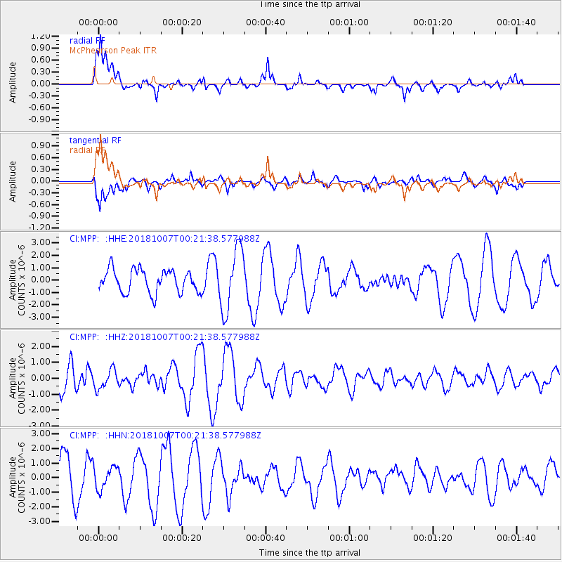
MPP McPhearson Peak - Earthquake Result Viewer
*The percent match for this event was below the threshold and hence no stack was calculated.
| Earthquake location: |
Central Mid-Atlantic Ridge |
| Earthquake latitude/longitude: |
7.6/-37.7 |
| Earthquake time(UTC): |
2018/10/07 (280) 00:10:05 GMT |
| Earthquake Depth: |
10 km |
| Earthquake Magnitude: |
5.6 Mww |
| Earthquake Catalog/Contributor: |
NEIC PDE/us |
|
| Network: |
CI Caltech Regional Seismic Network |
| Station: |
MPP McPhearson Peak |
| Lat/Lon: |
34.89 N/119.81 W |
| Elevation: |
1739 m |
|
| Distance: |
79.3 deg |
| Az: |
304.022 deg |
| Baz: |
88.207 deg |
| Ray Param: |
$rayparam |
*The percent match for this event was below the threshold and hence was not used in the summary stack. |
|
| Radial Match: |
66.4233 % |
| Radial Bump: |
400 |
| Transverse Match: |
67.365135 % |
| Transverse Bump: |
400 |
| SOD ConfigId: |
13570011 |
| Insert Time: |
2019-05-01 10:06:05.724 +0000 |
| GWidth: |
2.5 |
| Max Bumps: |
400 |
| Tol: |
0.001 |
|
Signal To Noise
| Channel | StoN | STA | LTA |
| CI:MPP: :HHZ:20181007T00:21:38.577988Z | 0.68297243 | 6.1019637E-7 | 8.934422E-7 |
| CI:MPP: :HHN:20181007T00:21:38.577988Z | 0.711998 | 7.558843E-7 | 1.0616383E-6 |
| CI:MPP: :HHE:20181007T00:21:38.577988Z | 2.5937696 | 2.4202104E-6 | 9.330861E-7 |
| Arrivals |
| Ps | |
| PpPs | |
| PsPs/PpSs | |


