You are here: Home > Network List > TA - USArray Transportable Network (new EarthScope stations) Stations List
> Station E18K Tukpahlearik Creek, AK, USA > Earthquake Result Viewer
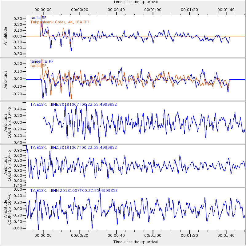
E18K Tukpahlearik Creek, AK, USA - Earthquake Result Viewer
*The percent match for this event was below the threshold and hence no stack was calculated.
| Earthquake location: |
Central Mid-Atlantic Ridge |
| Earthquake latitude/longitude: |
7.6/-37.7 |
| Earthquake time(UTC): |
2018/10/07 (280) 00:10:05 GMT |
| Earthquake Depth: |
10 km |
| Earthquake Magnitude: |
5.6 Mww |
| Earthquake Catalog/Contributor: |
NEIC PDE/us |
|
| Network: |
TA USArray Transportable Network (new EarthScope stations) |
| Station: |
E18K Tukpahlearik Creek, AK, USA |
| Lat/Lon: |
67.42 N/160.60 W |
| Elevation: |
297 m |
|
| Distance: |
95.0 deg |
| Az: |
341.016 deg |
| Baz: |
56.633 deg |
| Ray Param: |
$rayparam |
*The percent match for this event was below the threshold and hence was not used in the summary stack. |
|
| Radial Match: |
61.646145 % |
| Radial Bump: |
400 |
| Transverse Match: |
65.9751 % |
| Transverse Bump: |
400 |
| SOD ConfigId: |
13570011 |
| Insert Time: |
2019-05-01 10:10:48.089 +0000 |
| GWidth: |
2.5 |
| Max Bumps: |
400 |
| Tol: |
0.001 |
|
Signal To Noise
| Channel | StoN | STA | LTA |
| TA:E18K: :BHZ:20181007T00:22:55.499985Z | 0.8004052 | 4.0036406E-7 | 5.0020174E-7 |
| TA:E18K: :BHN:20181007T00:22:55.499985Z | 1.1763052 | 1.9553723E-7 | 1.6623002E-7 |
| TA:E18K: :BHE:20181007T00:22:55.499985Z | 1.122999 | 2.6669053E-7 | 2.3748066E-7 |
| Arrivals |
| Ps | |
| PpPs | |
| PsPs/PpSs | |


