You are here: Home > Network List > TA - USArray Transportable Network (new EarthScope stations) Stations List
> Station F26K Sheenjek River, AK, USA > Earthquake Result Viewer
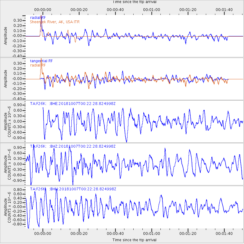
F26K Sheenjek River, AK, USA - Earthquake Result Viewer
*The percent match for this event was below the threshold and hence no stack was calculated.
| Earthquake location: |
Central Mid-Atlantic Ridge |
| Earthquake latitude/longitude: |
7.6/-37.7 |
| Earthquake time(UTC): |
2018/10/07 (280) 00:10:05 GMT |
| Earthquake Depth: |
10 km |
| Earthquake Magnitude: |
5.6 Mww |
| Earthquake Catalog/Contributor: |
NEIC PDE/us |
|
| Network: |
TA USArray Transportable Network (new EarthScope stations) |
| Station: |
F26K Sheenjek River, AK, USA |
| Lat/Lon: |
67.69 N/144.15 W |
| Elevation: |
683 m |
|
| Distance: |
89.2 deg |
| Az: |
338.526 deg |
| Baz: |
71.935 deg |
| Ray Param: |
$rayparam |
*The percent match for this event was below the threshold and hence was not used in the summary stack. |
|
| Radial Match: |
70.98953 % |
| Radial Bump: |
400 |
| Transverse Match: |
76.654144 % |
| Transverse Bump: |
400 |
| SOD ConfigId: |
13570011 |
| Insert Time: |
2019-05-01 10:10:54.834 +0000 |
| GWidth: |
2.5 |
| Max Bumps: |
400 |
| Tol: |
0.001 |
|
Signal To Noise
| Channel | StoN | STA | LTA |
| TA:F26K: :BHZ:20181007T00:22:28.824998Z | 0.43837902 | 4.0161788E-7 | 9.161431E-7 |
| TA:F26K: :BHN:20181007T00:22:28.824998Z | 1.2269121 | 4.348888E-7 | 3.5445797E-7 |
| TA:F26K: :BHE:20181007T00:22:28.824998Z | 0.8705572 | 3.5637524E-7 | 4.0936453E-7 |
| Arrivals |
| Ps | |
| PpPs | |
| PsPs/PpSs | |


