You are here: Home > Network List > TA - USArray Transportable Network (new EarthScope stations) Stations List
> Station R17A Hanksville Airport, Hanksville, UT, USA > Earthquake Result Viewer
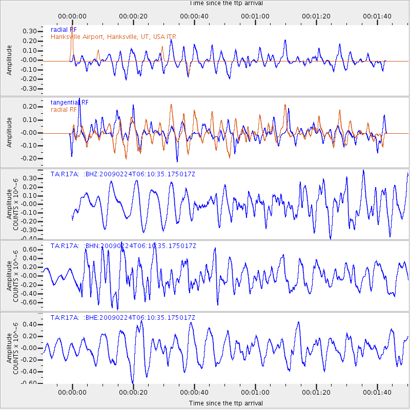
R17A Hanksville Airport, Hanksville, UT, USA - Earthquake Result Viewer
*The percent match for this event was below the threshold and hence no stack was calculated.
| Earthquake location: |
South Of Mariana Islands |
| Earthquake latitude/longitude: |
13.8/146.3 |
| Earthquake time(UTC): |
2009/02/24 (055) 05:57:59 GMT |
| Earthquake Depth: |
5.0 km |
| Earthquake Magnitude: |
5.7 MB, 5.7 MS, 5.9 MW, 5.8 MW |
| Earthquake Catalog/Contributor: |
WHDF/NEIC |
|
| Network: |
TA USArray Transportable Network (new EarthScope stations) |
| Station: |
R17A Hanksville Airport, Hanksville, UT, USA |
| Lat/Lon: |
38.42 N/110.71 W |
| Elevation: |
1357 m |
|
| Distance: |
91.4 deg |
| Az: |
49.967 deg |
| Baz: |
288.734 deg |
| Ray Param: |
$rayparam |
*The percent match for this event was below the threshold and hence was not used in the summary stack. |
|
| Radial Match: |
55.16126 % |
| Radial Bump: |
400 |
| Transverse Match: |
67.67699 % |
| Transverse Bump: |
400 |
| SOD ConfigId: |
2658 |
| Insert Time: |
2010-03-06 16:28:59.487 +0000 |
| GWidth: |
2.5 |
| Max Bumps: |
400 |
| Tol: |
0.001 |
|
Signal To Noise
| Channel | StoN | STA | LTA |
| TA:R17A: :BHN:20090224T06:10:35.175017Z | 3.0188901 | 2.7944768E-7 | 9.256636E-8 |
| TA:R17A: :BHE:20090224T06:10:35.175017Z | 0.6679668 | 9.102835E-8 | 1.3627675E-7 |
| TA:R17A: :BHZ:20090224T06:10:35.175017Z | 1.3489757 | 1.9805807E-7 | 1.468211E-7 |
| Arrivals |
| Ps | |
| PpPs | |
| PsPs/PpSs | |


