You are here: Home > Network List > TA - USArray Transportable Network (new EarthScope stations) Stations List
> Station R17A Hanksville Airport, Hanksville, UT, USA > Earthquake Result Viewer
R17A Hanksville Airport, Hanksville, UT, USA - Earthquake Result Viewer
*The percent match for this event was below the threshold and hence no stack was calculated.
| Earthquake location: |
Fiji Islands Region |
| Earthquake latitude/longitude: |
-17.8/-178.7 |
| Earthquake time(UTC): |
2009/01/27 (027) 06:29:13 GMT |
| Earthquake Depth: |
601 km |
| Earthquake Magnitude: |
5.9 MW, 5.1 MB, 5.8 MW |
| Earthquake Catalog/Contributor: |
WHDF/NEIC |
|
| Network: |
TA USArray Transportable Network (new EarthScope stations) |
| Station: |
R17A Hanksville Airport, Hanksville, UT, USA |
| Lat/Lon: |
38.42 N/110.71 W |
| Elevation: |
1357 m |
|
| Distance: |
84.7 deg |
| Az: |
46.993 deg |
| Baz: |
242.467 deg |
| Ray Param: |
$rayparam |
*The percent match for this event was below the threshold and hence was not used in the summary stack. |
|
| Radial Match: |
70.570366 % |
| Radial Bump: |
331 |
| Transverse Match: |
68.68465 % |
| Transverse Bump: |
356 |
| SOD ConfigId: |
2658 |
| Insert Time: |
2010-03-06 16:29:05.434 +0000 |
| GWidth: |
2.5 |
| Max Bumps: |
400 |
| Tol: |
0.001 |
|
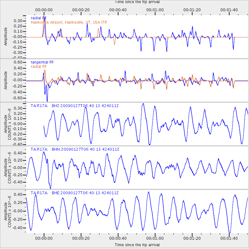
Signal To Noise
| Channel | StoN | STA | LTA |
| TA:R17A: :BHN:20090127T06:40:13.424011Z | 1.8509954 | 3.3865646E-7 | 1.829591E-7 |
| TA:R17A: :BHE:20090127T06:40:13.424011Z | 0.35623837 | 8.096414E-8 | 2.2727518E-7 |
| TA:R17A: :BHZ:20090127T06:40:13.424011Z | 0.7772617 | 1.2647955E-7 | 1.6272453E-7 |
| Arrivals |
| Ps | |
| PpPs | |
| PsPs/PpSs | |


