You are here: Home > Network List > IU - Global Seismograph Network (GSN - IRIS/USGS) Stations List
> Station RSSD Black Hills, South Dakota, USA > Earthquake Result Viewer
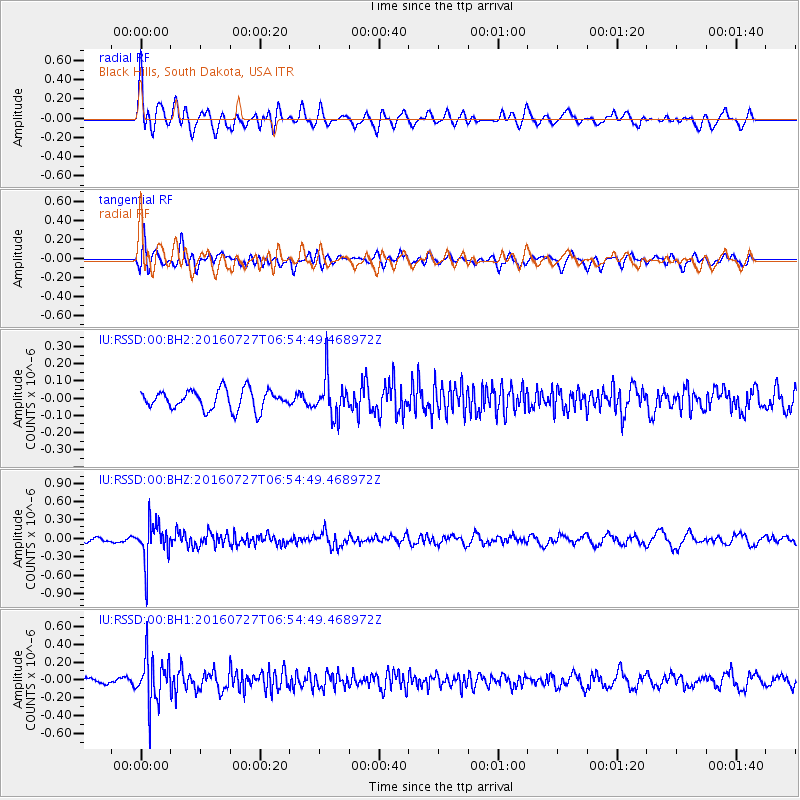
RSSD Black Hills, South Dakota, USA - Earthquake Result Viewer
*The percent match for this event was below the threshold and hence no stack was calculated.
| Earthquake location: |
Chile-Argentina Border Region |
| Earthquake latitude/longitude: |
-24.3/-67.9 |
| Earthquake time(UTC): |
2016/07/27 (209) 06:43:45 GMT |
| Earthquake Depth: |
99 km |
| Earthquake Magnitude: |
5.6 MB |
| Earthquake Catalog/Contributor: |
NEIC PDE/NEIC COMCAT |
|
| Network: |
IU Global Seismograph Network (GSN - IRIS/USGS) |
| Station: |
RSSD Black Hills, South Dakota, USA |
| Lat/Lon: |
44.12 N/104.04 W |
| Elevation: |
2090 m |
|
| Distance: |
75.7 deg |
| Az: |
333.984 deg |
| Baz: |
146.236 deg |
| Ray Param: |
$rayparam |
*The percent match for this event was below the threshold and hence was not used in the summary stack. |
|
| Radial Match: |
70.17362 % |
| Radial Bump: |
400 |
| Transverse Match: |
60.174473 % |
| Transverse Bump: |
400 |
| SOD ConfigId: |
1634031 |
| Insert Time: |
2016-08-10 06:45:48.151 +0000 |
| GWidth: |
2.5 |
| Max Bumps: |
400 |
| Tol: |
0.001 |
|
Signal To Noise
| Channel | StoN | STA | LTA |
| IU:RSSD:00:BHZ:20160727T06:54:49.468972Z | 7.5008006 | 3.2214538E-7 | 4.2948134E-8 |
| IU:RSSD:00:BH1:20160727T06:54:49.468972Z | 6.748109 | 2.6614526E-7 | 3.9439982E-8 |
| IU:RSSD:00:BH2:20160727T06:54:49.468972Z | 1.9759367 | 1.1279889E-7 | 5.708629E-8 |
| Arrivals |
| Ps | |
| PpPs | |
| PsPs/PpSs | |


