You are here: Home > Network List > TA - USArray Transportable Network (new EarthScope stations) Stations List
> Station B18K Kokolik River, AK, USA > Earthquake Result Viewer
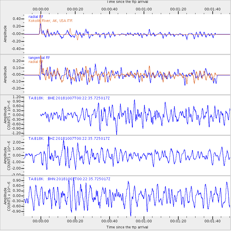
B18K Kokolik River, AK, USA - Earthquake Result Viewer
*The percent match for this event was below the threshold and hence no stack was calculated.
| Earthquake location: |
Haiti Region |
| Earthquake latitude/longitude: |
20.0/-73.0 |
| Earthquake time(UTC): |
2018/10/07 (280) 00:11:49 GMT |
| Earthquake Depth: |
12 km |
| Earthquake Magnitude: |
5.9 Mww |
| Earthquake Catalog/Contributor: |
NEIC PDE/us |
|
| Network: |
TA USArray Transportable Network (new EarthScope stations) |
| Station: |
B18K Kokolik River, AK, USA |
| Lat/Lon: |
69.36 N/161.80 W |
| Elevation: |
222 m |
|
| Distance: |
71.0 deg |
| Az: |
337.986 deg |
| Baz: |
83.761 deg |
| Ray Param: |
$rayparam |
*The percent match for this event was below the threshold and hence was not used in the summary stack. |
|
| Radial Match: |
58.827892 % |
| Radial Bump: |
400 |
| Transverse Match: |
59.229156 % |
| Transverse Bump: |
400 |
| SOD ConfigId: |
13570011 |
| Insert Time: |
2019-05-01 10:19:35.210 +0000 |
| GWidth: |
2.5 |
| Max Bumps: |
400 |
| Tol: |
0.001 |
|
Signal To Noise
| Channel | StoN | STA | LTA |
| TA:B18K: :BHZ:20181007T00:22:35.725017Z | 4.1124473 | 1.2032674E-6 | 2.9259155E-7 |
| TA:B18K: :BHN:20181007T00:22:35.725017Z | 1.1547365 | 3.1857394E-7 | 2.7588453E-7 |
| TA:B18K: :BHE:20181007T00:22:35.725017Z | 2.5918388 | 4.9601937E-7 | 1.9137741E-7 |
| Arrivals |
| Ps | |
| PpPs | |
| PsPs/PpSs | |


