You are here: Home > Network List > TA - USArray Transportable Network (new EarthScope stations) Stations List
> Station C16K Lisburne Hills, AK, USA > Earthquake Result Viewer
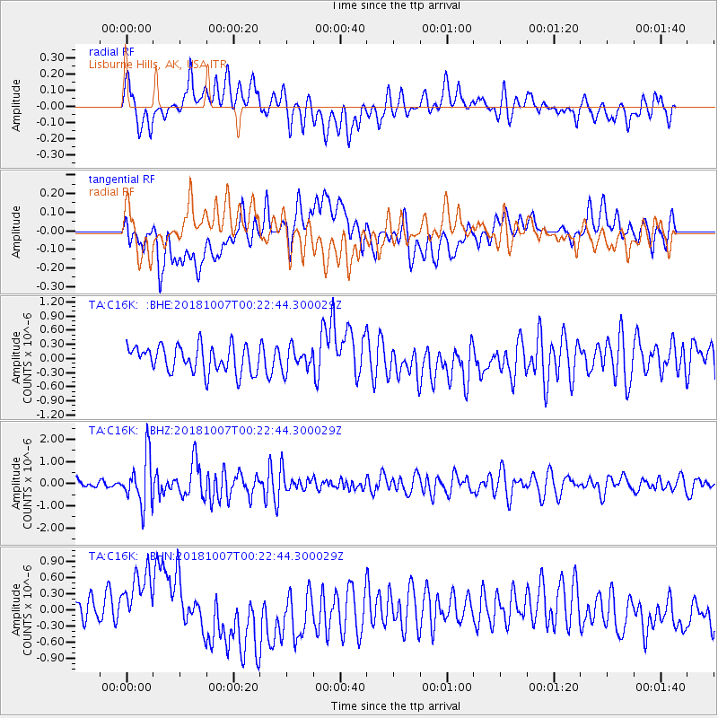
C16K Lisburne Hills, AK, USA - Earthquake Result Viewer
*The percent match for this event was below the threshold and hence no stack was calculated.
| Earthquake location: |
Haiti Region |
| Earthquake latitude/longitude: |
20.0/-73.0 |
| Earthquake time(UTC): |
2018/10/07 (280) 00:11:49 GMT |
| Earthquake Depth: |
12 km |
| Earthquake Magnitude: |
5.9 Mww |
| Earthquake Catalog/Contributor: |
NEIC PDE/us |
|
| Network: |
TA USArray Transportable Network (new EarthScope stations) |
| Station: |
C16K Lisburne Hills, AK, USA |
| Lat/Lon: |
68.27 N/165.34 W |
| Elevation: |
102 m |
|
| Distance: |
72.4 deg |
| Az: |
337.035 deg |
| Baz: |
80.162 deg |
| Ray Param: |
$rayparam |
*The percent match for this event was below the threshold and hence was not used in the summary stack. |
|
| Radial Match: |
55.192516 % |
| Radial Bump: |
400 |
| Transverse Match: |
44.534946 % |
| Transverse Bump: |
400 |
| SOD ConfigId: |
13570011 |
| Insert Time: |
2019-05-01 10:19:38.124 +0000 |
| GWidth: |
2.5 |
| Max Bumps: |
400 |
| Tol: |
0.001 |
|
Signal To Noise
| Channel | StoN | STA | LTA |
| TA:C16K: :BHZ:20181007T00:22:44.300029Z | 3.960613 | 1.1056438E-6 | 2.7915976E-7 |
| TA:C16K: :BHN:20181007T00:22:44.300029Z | 1.9940841 | 6.233272E-7 | 3.125882E-7 |
| TA:C16K: :BHE:20181007T00:22:44.300029Z | 0.86456656 | 2.4040645E-7 | 2.7806587E-7 |
| Arrivals |
| Ps | |
| PpPs | |
| PsPs/PpSs | |


