You are here: Home > Network List > TA - USArray Transportable Network (new EarthScope stations) Stations List
> Station H16K Elim, AK, USA > Earthquake Result Viewer
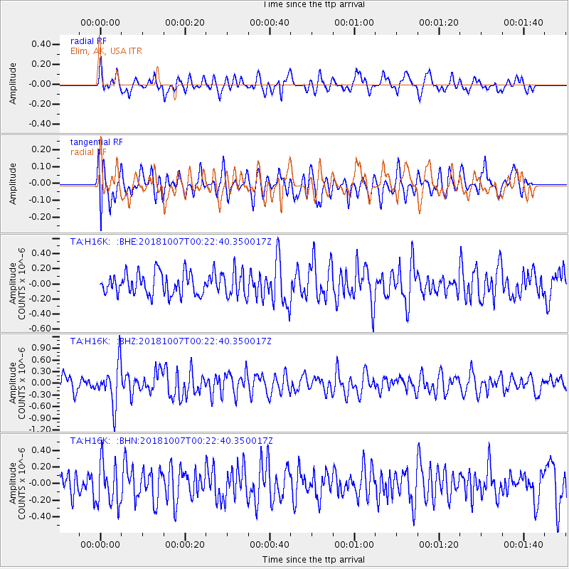
H16K Elim, AK, USA - Earthquake Result Viewer
*The percent match for this event was below the threshold and hence no stack was calculated.
| Earthquake location: |
Haiti Region |
| Earthquake latitude/longitude: |
20.0/-73.0 |
| Earthquake time(UTC): |
2018/10/07 (280) 00:11:49 GMT |
| Earthquake Depth: |
12 km |
| Earthquake Magnitude: |
5.9 Mww |
| Earthquake Catalog/Contributor: |
NEIC PDE/us |
|
| Network: |
TA USArray Transportable Network (new EarthScope stations) |
| Station: |
H16K Elim, AK, USA |
| Lat/Lon: |
64.64 N/162.24 W |
| Elevation: |
216 m |
|
| Distance: |
71.8 deg |
| Az: |
333.039 deg |
| Baz: |
81.779 deg |
| Ray Param: |
$rayparam |
*The percent match for this event was below the threshold and hence was not used in the summary stack. |
|
| Radial Match: |
55.89828 % |
| Radial Bump: |
400 |
| Transverse Match: |
60.044247 % |
| Transverse Bump: |
400 |
| SOD ConfigId: |
13570011 |
| Insert Time: |
2019-05-01 10:20:19.810 +0000 |
| GWidth: |
2.5 |
| Max Bumps: |
400 |
| Tol: |
0.001 |
|
Signal To Noise
| Channel | StoN | STA | LTA |
| TA:H16K: :BHZ:20181007T00:22:40.350017Z | 3.0937402 | 5.4444587E-7 | 1.7598306E-7 |
| TA:H16K: :BHN:20181007T00:22:40.350017Z | 1.8164668 | 2.5828462E-7 | 1.4219066E-7 |
| TA:H16K: :BHE:20181007T00:22:40.350017Z | 1.2467005 | 1.75122E-7 | 1.4046839E-7 |
| Arrivals |
| Ps | |
| PpPs | |
| PsPs/PpSs | |


