
O18A Roosevelt, UT, USA - Earthquake Result Viewer
| ||||||||||||||||||
| ||||||||||||||||||
| ||||||||||||||||||
|
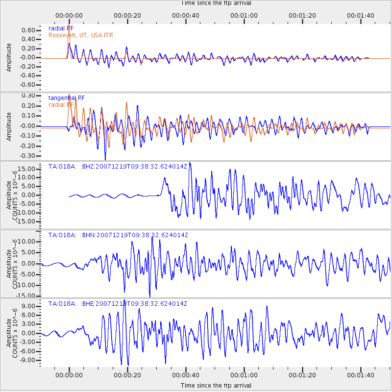
Signal To Noise
| Channel | StoN | STA | LTA |
| TA:O18A: :BHN:20071219T09:38:32.624014Z | 2.5570486 | 1.2166136E-6 | 4.7578823E-7 |
| TA:O18A: :BHE:20071219T09:38:32.624014Z | 2.7753468 | 1.2662463E-6 | 4.56248E-7 |
| TA:O18A: :BHZ:20071219T09:38:32.624014Z | 7.4088335 | 4.568701E-6 | 6.166559E-7 |
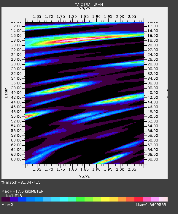
| Arrivals | |
| Ps | 2.4 SECOND |
| PpPs | 7.6 SECOND |
| PsPs/PpSs | 10 SECOND |

