You are here: Home > Network List > US - United States National Seismic Network Stations List
> Station WMOK Wichita Mountains, Oklahoma, USA > Earthquake Result Viewer
WMOK Wichita Mountains, Oklahoma, USA - Earthquake Result Viewer
*The percent match for this event was below the threshold and hence no stack was calculated.
| Earthquake location: |
Chile-Argentina Border Region |
| Earthquake latitude/longitude: |
-24.3/-67.9 |
| Earthquake time(UTC): |
2016/07/27 (209) 06:43:45 GMT |
| Earthquake Depth: |
99 km |
| Earthquake Magnitude: |
5.6 MB |
| Earthquake Catalog/Contributor: |
NEIC PDE/NEIC COMCAT |
|
| Network: |
US United States National Seismic Network |
| Station: |
WMOK Wichita Mountains, Oklahoma, USA |
| Lat/Lon: |
34.74 N/98.78 W |
| Elevation: |
486 m |
|
| Distance: |
65.6 deg |
| Az: |
332.319 deg |
| Baz: |
149.02 deg |
| Ray Param: |
$rayparam |
*The percent match for this event was below the threshold and hence was not used in the summary stack. |
|
| Radial Match: |
27.980135 % |
| Radial Bump: |
400 |
| Transverse Match: |
23.078138 % |
| Transverse Bump: |
400 |
| SOD ConfigId: |
1634031 |
| Insert Time: |
2016-08-10 06:47:58.059 +0000 |
| GWidth: |
2.5 |
| Max Bumps: |
400 |
| Tol: |
0.001 |
|
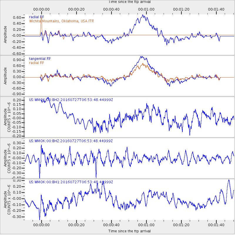
Signal To Noise
| Channel | StoN | STA | LTA |
| US:WMOK:00:BHZ:20160727T06:53:48.44999Z | 3.2732542 | 1.3806097E-7 | 4.2178506E-8 |
| US:WMOK:00:BH1:20160727T06:53:48.44999Z | 1.8919283 | 2.9913804E-7 | 1.5811277E-7 |
| US:WMOK:00:BH2:20160727T06:53:48.44999Z | 1.9894695 | 1.7804989E-7 | 8.949616E-8 |
| Arrivals |
| Ps | |
| PpPs | |
| PsPs/PpSs | |


