You are here: Home > Network List > TA - USArray Transportable Network (new EarthScope stations) Stations List
> Station O18A Roosevelt, UT, USA > Earthquake Result Viewer
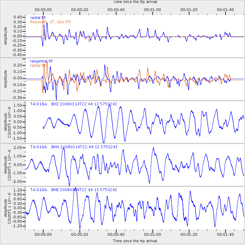
O18A Roosevelt, UT, USA - Earthquake Result Viewer
*The percent match for this event was below the threshold and hence no stack was calculated.
| Earthquake location: |
Bonin Islands, Japan Region |
| Earthquake latitude/longitude: |
27.0/142.6 |
| Earthquake time(UTC): |
2008/03/14 (074) 22:32:09 GMT |
| Earthquake Depth: |
11 km |
| Earthquake Magnitude: |
5.7 MB, 5.9 MS, 6.0 MW, 6.0 MW |
| Earthquake Catalog/Contributor: |
WHDF/NEIC |
|
| Network: |
TA USArray Transportable Network (new EarthScope stations) |
| Station: |
O18A Roosevelt, UT, USA |
| Lat/Lon: |
40.27 N/110.01 W |
| Elevation: |
1582 m |
|
| Distance: |
85.0 deg |
| Az: |
47.134 deg |
| Baz: |
301.27 deg |
| Ray Param: |
$rayparam |
*The percent match for this event was below the threshold and hence was not used in the summary stack. |
|
| Radial Match: |
30.409107 % |
| Radial Bump: |
380 |
| Transverse Match: |
72.488976 % |
| Transverse Bump: |
400 |
| SOD ConfigId: |
2504 |
| Insert Time: |
2010-03-06 16:34:00.595 +0000 |
| GWidth: |
2.5 |
| Max Bumps: |
400 |
| Tol: |
0.001 |
|
Signal To Noise
| Channel | StoN | STA | LTA |
| TA:O18A: :BHN:20080314T22:44:13.575024Z | 1.029545 | 5.429802E-7 | 5.2739824E-7 |
| TA:O18A: :BHE:20080314T22:44:13.575024Z | 0.749938 | 3.5982487E-7 | 4.7980615E-7 |
| TA:O18A: :BHZ:20080314T22:44:13.575024Z | 2.4663966 | 1.1817208E-6 | 4.7912846E-7 |
| Arrivals |
| Ps | |
| PpPs | |
| PsPs/PpSs | |


