You are here: Home > Network List > US - United States National Seismic Network Stations List
> Station CBKS Cedar Bluff, Kansas, USA > Earthquake Result Viewer
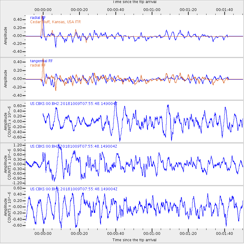
CBKS Cedar Bluff, Kansas, USA - Earthquake Result Viewer
*The percent match for this event was below the threshold and hence no stack was calculated.
| Earthquake location: |
Kuril Islands |
| Earthquake latitude/longitude: |
49.4/156.2 |
| Earthquake time(UTC): |
2018/10/09 (282) 07:45:14 GMT |
| Earthquake Depth: |
42 km |
| Earthquake Magnitude: |
6.0 Mww |
| Earthquake Catalog/Contributor: |
NEIC PDE/us |
|
| Network: |
US United States National Seismic Network |
| Station: |
CBKS Cedar Bluff, Kansas, USA |
| Lat/Lon: |
38.81 N/99.74 W |
| Elevation: |
677 m |
|
| Distance: |
69.6 deg |
| Az: |
53.944 deg |
| Baz: |
317.496 deg |
| Ray Param: |
$rayparam |
*The percent match for this event was below the threshold and hence was not used in the summary stack. |
|
| Radial Match: |
60.86662 % |
| Radial Bump: |
400 |
| Transverse Match: |
55.67772 % |
| Transverse Bump: |
400 |
| SOD ConfigId: |
13570011 |
| Insert Time: |
2019-05-01 10:50:35.675 +0000 |
| GWidth: |
2.5 |
| Max Bumps: |
400 |
| Tol: |
0.001 |
|
Signal To Noise
| Channel | StoN | STA | LTA |
| US:CBKS:00:BHZ:20181009T07:55:48.149004Z | 2.0153935 | 3.5885427E-7 | 1.7805667E-7 |
| US:CBKS:00:BH1:20181009T07:55:48.149004Z | 1.7066871 | 3.159962E-7 | 1.851518E-7 |
| US:CBKS:00:BH2:20181009T07:55:48.149004Z | 0.8967161 | 1.7030649E-7 | 1.8992243E-7 |
| Arrivals |
| Ps | |
| PpPs | |
| PsPs/PpSs | |


