You are here: Home > Network List > TA - USArray Transportable Network (new EarthScope stations) Stations List
> Station D25K Kavik River, AK, USA > Earthquake Result Viewer
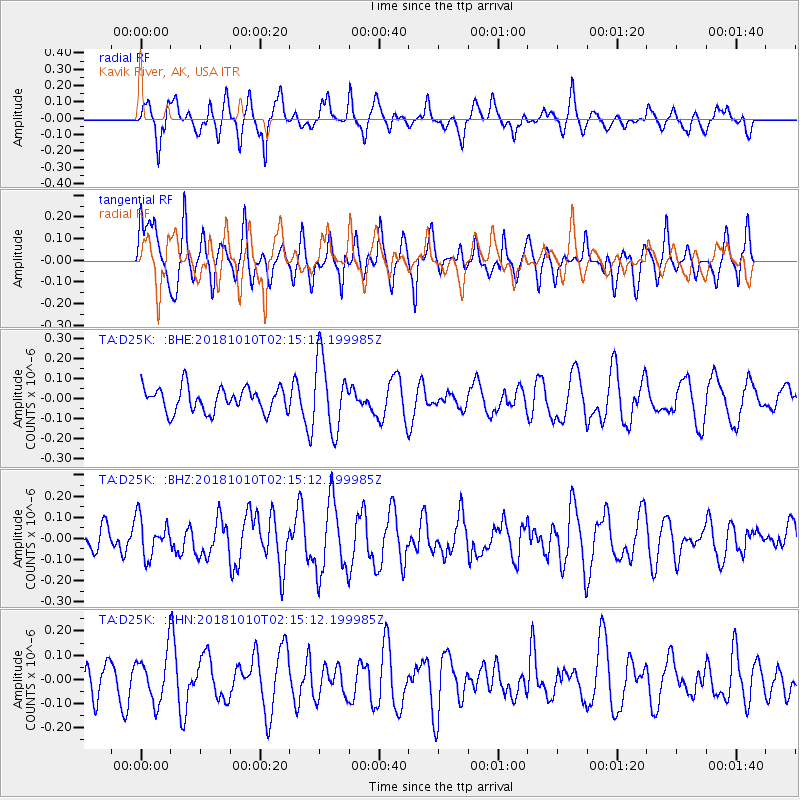
D25K Kavik River, AK, USA - Earthquake Result Viewer
*The percent match for this event was below the threshold and hence no stack was calculated.
| Earthquake location: |
Eastern New Guinea Reg., P.N.G. |
| Earthquake latitude/longitude: |
-6.1/147.5 |
| Earthquake time(UTC): |
2018/10/10 (283) 02:02:59 GMT |
| Earthquake Depth: |
36 km |
| Earthquake Magnitude: |
5.5 Mww |
| Earthquake Catalog/Contributor: |
NEIC PDE/us |
|
| Network: |
TA USArray Transportable Network (new EarthScope stations) |
| Station: |
D25K Kavik River, AK, USA |
| Lat/Lon: |
69.32 N/146.38 W |
| Elevation: |
770 m |
|
| Distance: |
87.5 deg |
| Az: |
18.979 deg |
| Baz: |
245.56 deg |
| Ray Param: |
$rayparam |
*The percent match for this event was below the threshold and hence was not used in the summary stack. |
|
| Radial Match: |
60.645927 % |
| Radial Bump: |
400 |
| Transverse Match: |
56.090446 % |
| Transverse Bump: |
400 |
| SOD ConfigId: |
13570011 |
| Insert Time: |
2019-05-01 10:55:10.373 +0000 |
| GWidth: |
2.5 |
| Max Bumps: |
400 |
| Tol: |
0.001 |
|
Signal To Noise
| Channel | StoN | STA | LTA |
| TA:D25K: :BHZ:20181010T02:15:12.199985Z | 1.3213801 | 8.965206E-8 | 6.7847296E-8 |
| TA:D25K: :BHN:20181010T02:15:12.199985Z | 1.1698401 | 1.02752296E-7 | 8.7834486E-8 |
| TA:D25K: :BHE:20181010T02:15:12.199985Z | 2.9201477 | 1.7617569E-7 | 6.03311E-8 |
| Arrivals |
| Ps | |
| PpPs | |
| PsPs/PpSs | |


