You are here: Home > Network List > TA - USArray Transportable Network (new EarthScope stations) Stations List
> Station O18A Roosevelt, UT, USA > Earthquake Result Viewer
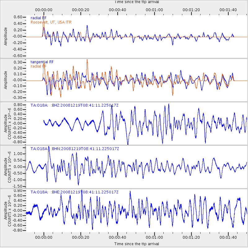
O18A Roosevelt, UT, USA - Earthquake Result Viewer
*The percent match for this event was below the threshold and hence no stack was calculated.
| Earthquake location: |
Northern Mid-Atlantic Ridge |
| Earthquake latitude/longitude: |
47.0/-27.3 |
| Earthquake time(UTC): |
2008/12/19 (354) 08:31:51 GMT |
| Earthquake Depth: |
2.0 km |
| Earthquake Magnitude: |
5.8 MB, 5.6 MS, 5.9 MW, 5.8 MW |
| Earthquake Catalog/Contributor: |
WHDF/NEIC |
|
| Network: |
TA USArray Transportable Network (new EarthScope stations) |
| Station: |
O18A Roosevelt, UT, USA |
| Lat/Lon: |
40.27 N/110.01 W |
| Elevation: |
1582 m |
|
| Distance: |
57.6 deg |
| Az: |
295.984 deg |
| Baz: |
53.518 deg |
| Ray Param: |
$rayparam |
*The percent match for this event was below the threshold and hence was not used in the summary stack. |
|
| Radial Match: |
70.24703 % |
| Radial Bump: |
400 |
| Transverse Match: |
75.44436 % |
| Transverse Bump: |
400 |
| SOD ConfigId: |
2658 |
| Insert Time: |
2010-03-06 16:34:33.178 +0000 |
| GWidth: |
2.5 |
| Max Bumps: |
400 |
| Tol: |
0.001 |
|
Signal To Noise
| Channel | StoN | STA | LTA |
| TA:O18A: :BHN:20081219T08:41:11.225017Z | 2.8071988 | 6.2942104E-7 | 2.2421678E-7 |
| TA:O18A: :BHE:20081219T08:41:11.225017Z | 0.962692 | 1.2994406E-7 | 1.3497989E-7 |
| TA:O18A: :BHZ:20081219T08:41:11.225017Z | 2.5942602 | 3.2759334E-7 | 1.262762E-7 |
| Arrivals |
| Ps | |
| PpPs | |
| PsPs/PpSs | |


