J16A Bone, ID, USA - Earthquake Result Viewer
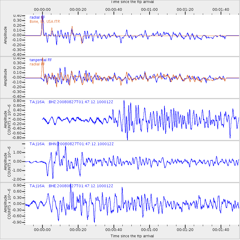
Earthquake location: Lake Baykal Region, Russia
Earthquake latitude/longitude: 51.6/104.2
Earthquake time(UTC): 2008/08/27 (240) 01:35:32 GMT
Earthquake Depth: 16 km
Earthquake Magnitude: 5.8 MB, 6.2 MS, 6.2 MW, 6.2 MW
Earthquake Catalog/Contributor: WHDF/NEIC
Network: TA USArray Transportable Network (new EarthScope stations)
Station: J16A Bone, ID, USA
Lat/Lon: 43.27 N/111.61 W
Elevation: 2004 m
Distance: 80.5 deg
Az: 25.646 deg
Baz: 338.312 deg
Ray Param: 0.048197556
Estimated Moho Depth: 35.75 km
Estimated Crust Vp/Vs: 1.97
Assumed Crust Vp: 6.207 km/s
Estimated Crust Vs: 3.151 km/s
Estimated Crust Poisson's Ratio: 0.33
Radial Match: 82.864105 %
Radial Bump: 400
Transverse Match: 77.930435 %
Transverse Bump: 400
SOD ConfigId: 2504
Insert Time: 2010-03-06 16:35:27.717 +0000
GWidth: 2.5
Max Bumps: 400
Tol: 0.001

Signal To Noise

ChannelStoNSTALTA
TA:J16A: :BHN:20080827T01:47:12.100012Z9.33385855.87948E-76.2990885E-8
TA:J16A: :BHE:20080827T01:47:12.100012Z2.33788662.3453079E-71.00317436E-7
TA:J16A: :BHZ:20080827T01:47:12.100012Z1.27419279.338726E-87.329131E-8
Arrivals
Ps5.7 SECOND
PpPs17 SECOND
PsPs/PpSs22 SECOND