You are here: Home > Network List > AV - Alaska Volcano Observatory Stations List
> Station PLBL Mt. Peulik Volcano, Alaska > Earthquake Result Viewer
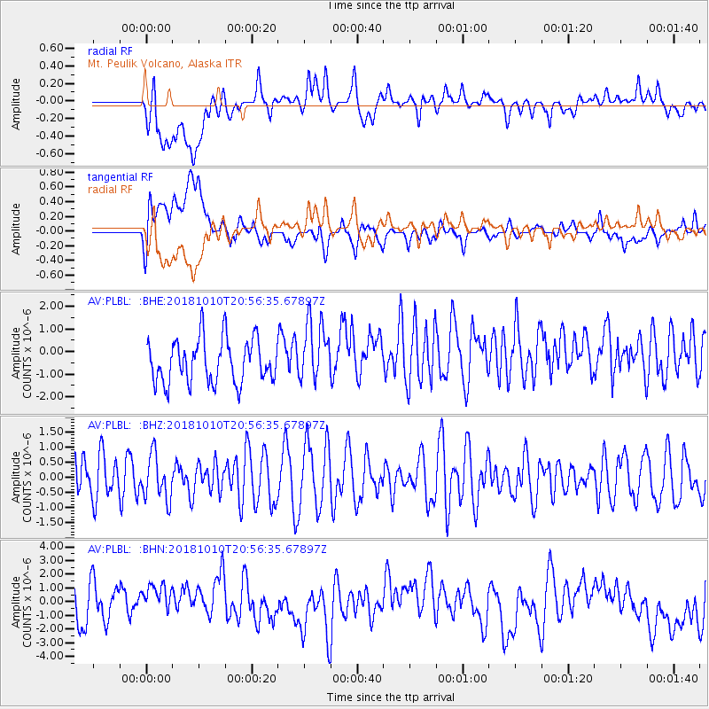
PLBL Mt. Peulik Volcano, Alaska - Earthquake Result Viewer
*The percent match for this event was below the threshold and hence no stack was calculated.
| Earthquake location: |
New Britain Region, P.N.G. |
| Earthquake latitude/longitude: |
-5.8/151.3 |
| Earthquake time(UTC): |
2018/10/10 (283) 20:45:26 GMT |
| Earthquake Depth: |
52 km |
| Earthquake Magnitude: |
5.9 mb |
| Earthquake Catalog/Contributor: |
NEIC PDE/us |
|
| Network: |
AV Alaska Volcano Observatory |
| Station: |
PLBL Mt. Peulik Volcano, Alaska |
| Lat/Lon: |
57.70 N/156.82 W |
| Elevation: |
461 m |
|
| Distance: |
75.8 deg |
| Az: |
25.822 deg |
| Baz: |
233.822 deg |
| Ray Param: |
$rayparam |
*The percent match for this event was below the threshold and hence was not used in the summary stack. |
|
| Radial Match: |
42.079227 % |
| Radial Bump: |
400 |
| Transverse Match: |
44.535973 % |
| Transverse Bump: |
400 |
| SOD ConfigId: |
13570011 |
| Insert Time: |
2019-05-01 11:02:27.526 +0000 |
| GWidth: |
2.5 |
| Max Bumps: |
400 |
| Tol: |
0.001 |
|
Signal To Noise
| Channel | StoN | STA | LTA |
| AV:PLBL: :BHZ:20181010T20:56:35.67897Z | 0.82007134 | 7.3136584E-7 | 8.91832E-7 |
| AV:PLBL: :BHN:20181010T20:56:35.67897Z | 1.0154296 | 1.9298254E-6 | 1.9005014E-6 |
| AV:PLBL: :BHE:20181010T20:56:35.67897Z | 1.3911189 | 1.3416296E-6 | 9.644249E-7 |
| Arrivals |
| Ps | |
| PpPs | |
| PsPs/PpSs | |


