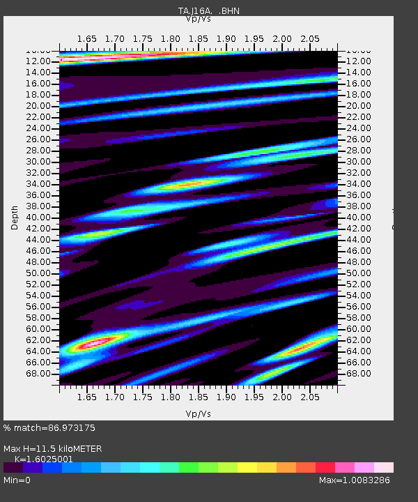
J16A Bone, ID, USA - Earthquake Result Viewer

Earthquake location: Kermadec Islands, New Zealand
Earthquake latitude/longitude: -29.8/-177.7
Earthquake time(UTC): 2008/09/29 (273) 15:19:31 GMT
Earthquake Depth: 36 km
Earthquake Magnitude: 6.5 MB, 6.7 MS, 7.0 MW, 7.0 MW
Earthquake Catalog/Contributor: WHDF/NEIC
Network: TA USArray Transportable Network (new EarthScope stations)
Station: J16A Bone, ID, USA
Lat/Lon: 43.27 N/111.61 W
Elevation: 2004 m
Distance: 94.6 deg
Az: 42.046 deg
Baz: 232.88 deg
Ray Param: 0.040996093
Estimated Moho Depth: 11.5 km
Estimated Crust Vp/Vs: 1.60
Assumed Crust Vp: 6.207 km/s
Estimated Crust Vs: 3.873 km/s
Estimated Crust Poisson's Ratio: 0.18
Radial Match: 86.973175 %
Radial Bump: 400
Transverse Match: 87.91202 %
Transverse Bump: 400
SOD ConfigId: 2560
Insert Time: 2010-03-06 16:35:32.899 +0000
GWidth: 2.5
Max Bumps: 400
Tol: 0.001

Signal To Noise

ChannelStoNSTALTA
TA:J16A: :BHN:20080929T15:32:17.123997Z4.04548654.1021516E-71.0140071E-7
TA:J16A: :BHE:20080929T15:32:17.123997Z0.970136762.3268261E-72.3984518E-7
TA:J16A: :BHZ:20080929T15:32:17.123997Z0.921156351.8822489E-72.0433545E-7
Arrivals
Ps1.1 SECOND
PpPs4.7 SECOND
PsPs/PpSs5.9 SECOND