You are here: Home > Network List > AZ - ANZA Regional Network Stations List
> Station SMER AZ.SMER > Earthquake Result Viewer
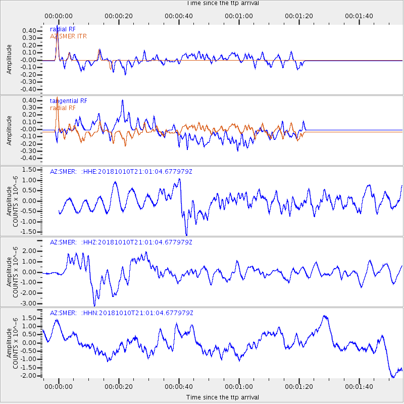
SMER AZ.SMER - Earthquake Result Viewer
*The percent match for this event was below the threshold and hence no stack was calculated.
| Earthquake location: |
New Britain Region, P.N.G. |
| Earthquake latitude/longitude: |
-5.9/151.4 |
| Earthquake time(UTC): |
2018/10/10 (283) 20:48:20 GMT |
| Earthquake Depth: |
33 km |
| Earthquake Magnitude: |
7.3 Mi |
| Earthquake Catalog/Contributor: |
NEIC PDE/at |
|
| Network: |
AZ ANZA Regional Network |
| Station: |
SMER AZ.SMER |
| Lat/Lon: |
33.46 N/117.17 W |
| Elevation: |
355 m |
|
| Distance: |
94.4 deg |
| Az: |
56.951 deg |
| Baz: |
265.873 deg |
| Ray Param: |
$rayparam |
*The percent match for this event was below the threshold and hence was not used in the summary stack. |
|
| Radial Match: |
57.647423 % |
| Radial Bump: |
400 |
| Transverse Match: |
37.213856 % |
| Transverse Bump: |
400 |
| SOD ConfigId: |
13570011 |
| Insert Time: |
2019-05-01 11:10:10.275 +0000 |
| GWidth: |
2.5 |
| Max Bumps: |
400 |
| Tol: |
0.001 |
|
Signal To Noise
| Channel | StoN | STA | LTA |
| AZ:SMER: :HHZ:20181010T21:01:04.677979Z | 4.0300083 | 8.420779E-7 | 2.089519E-7 |
| AZ:SMER: :HHN:20181010T21:01:04.677979Z | 1.6109253 | 1.1474242E-6 | 7.122765E-7 |
| AZ:SMER: :HHE:20181010T21:01:04.677979Z | 0.9331147 | 3.6809178E-7 | 3.9447644E-7 |
| Arrivals |
| Ps | |
| PpPs | |
| PsPs/PpSs | |


