You are here: Home > Network List > TA - USArray Transportable Network (new EarthScope stations) Stations List
> Station J16A Bone, ID, USA > Earthquake Result Viewer
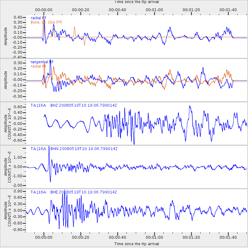
J16A Bone, ID, USA - Earthquake Result Viewer
*The percent match for this event was below the threshold and hence no stack was calculated.
| Earthquake location: |
E. Russia-N.E. China Border Reg. |
| Earthquake latitude/longitude: |
42.5/131.9 |
| Earthquake time(UTC): |
2008/05/19 (140) 10:08:36 GMT |
| Earthquake Depth: |
513 km |
| Earthquake Magnitude: |
5.7 MW, 5.4 MB, 5.6 MW |
| Earthquake Catalog/Contributor: |
WHDF/NEIC |
|
| Network: |
TA USArray Transportable Network (new EarthScope stations) |
| Station: |
J16A Bone, ID, USA |
| Lat/Lon: |
43.27 N/111.61 W |
| Elevation: |
2004 m |
|
| Distance: |
77.4 deg |
| Az: |
42.048 deg |
| Baz: |
317.303 deg |
| Ray Param: |
$rayparam |
*The percent match for this event was below the threshold and hence was not used in the summary stack. |
|
| Radial Match: |
50.73773 % |
| Radial Bump: |
400 |
| Transverse Match: |
58.53205 % |
| Transverse Bump: |
400 |
| SOD ConfigId: |
2504 |
| Insert Time: |
2010-03-06 16:36:57.229 +0000 |
| GWidth: |
2.5 |
| Max Bumps: |
400 |
| Tol: |
0.001 |
|
Signal To Noise
| Channel | StoN | STA | LTA |
| TA:J16A: :BHN:20080519T10:19:06.799014Z | 8.9205265 | 7.2393823E-7 | 8.11542E-8 |
| TA:J16A: :BHE:20080519T10:19:06.799014Z | 2.1023948 | 2.3505811E-7 | 1.1180494E-7 |
| TA:J16A: :BHZ:20080519T10:19:06.799014Z | 1.5145175 | 1.9396391E-7 | 1.2806977E-7 |
| Arrivals |
| Ps | |
| PpPs | |
| PsPs/PpSs | |


