You are here: Home > Network List > US - United States National Seismic Network Stations List
> Station EGMT Eagleton, Montana, USA > Earthquake Result Viewer
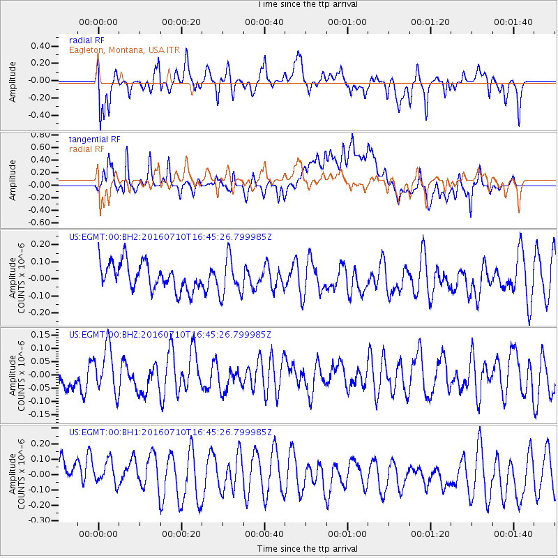
EGMT Eagleton, Montana, USA - Earthquake Result Viewer
*The percent match for this event was below the threshold and hence no stack was calculated.
| Earthquake location: |
Vanuatu Islands |
| Earthquake latitude/longitude: |
-14.6/167.4 |
| Earthquake time(UTC): |
2016/07/10 (192) 16:32:49 GMT |
| Earthquake Depth: |
167 km |
| Earthquake Magnitude: |
5.6 MWW, 5.6 MWC, 5.7 MWB |
| Earthquake Catalog/Contributor: |
NEIC PDE/NEIC COMCAT |
|
| Network: |
US United States National Seismic Network |
| Station: |
EGMT Eagleton, Montana, USA |
| Lat/Lon: |
48.02 N/109.75 W |
| Elevation: |
1055 m |
|
| Distance: |
96.0 deg |
| Az: |
42.053 deg |
| Baz: |
254.981 deg |
| Ray Param: |
$rayparam |
*The percent match for this event was below the threshold and hence was not used in the summary stack. |
|
| Radial Match: |
58.24954 % |
| Radial Bump: |
400 |
| Transverse Match: |
45.95322 % |
| Transverse Bump: |
400 |
| SOD ConfigId: |
1634031 |
| Insert Time: |
2016-08-10 15:13:40.585 +0000 |
| GWidth: |
2.5 |
| Max Bumps: |
400 |
| Tol: |
0.001 |
|
Signal To Noise
| Channel | StoN | STA | LTA |
| US:EGMT:00:BHZ:20160710T16:45:26.799985Z | 1.4914207 | 8.851132E-8 | 5.934698E-8 |
| US:EGMT:00:BH1:20160710T16:45:26.799985Z | 0.9132992 | 1.2922888E-7 | 1.4149677E-7 |
| US:EGMT:00:BH2:20160710T16:45:26.799985Z | 1.4529533 | 1.1425197E-7 | 7.8634294E-8 |
| Arrivals |
| Ps | |
| PpPs | |
| PsPs/PpSs | |


