
BAR Barrett Dam, California, USA - Earthquake Result Viewer
| ||||||||||||||||||
| ||||||||||||||||||
| ||||||||||||||||||
|
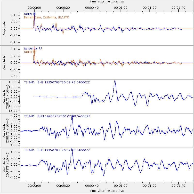
Signal To Noise
| Channel | StoN | STA | LTA |
| TS:BAR: :BHN:19950703T20:02:48.040002Z | 3.990647 | 3.2207083E-7 | 8.070642E-8 |
| TS:BAR: :BHE:19950703T20:02:48.040002Z | 5.354253 | 5.980143E-7 | 1.11689594E-7 |
| TS:BAR: :BHZ:19950703T20:02:48.040002Z | 13.651398 | 1.7179492E-6 | 1.258442E-7 |
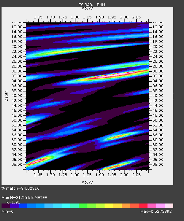
| Arrivals | |
| Ps | 4.9 SECOND |
| PpPs | 14 SECOND |
| PsPs/PpSs | 19 SECOND |

