You are here: Home > Network List > TA - USArray Transportable Network (new EarthScope stations) Stations List
> Station J16A Bone, ID, USA > Earthquake Result Viewer
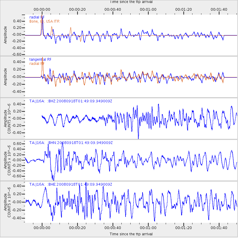
J16A Bone, ID, USA - Earthquake Result Viewer
*The percent match for this event was below the threshold and hence no stack was calculated.
| Earthquake location: |
Central East Pacific Rise |
| Earthquake latitude/longitude: |
-4.6/-106.0 |
| Earthquake time(UTC): |
2008/09/18 (262) 01:41:02 GMT |
| Earthquake Depth: |
10 km |
| Earthquake Magnitude: |
5.5 MB, 5.7 MS, 6.0 MW, 6.0 MW |
| Earthquake Catalog/Contributor: |
WHDF/NEIC |
|
| Network: |
TA USArray Transportable Network (new EarthScope stations) |
| Station: |
J16A Bone, ID, USA |
| Lat/Lon: |
43.27 N/111.61 W |
| Elevation: |
2004 m |
|
| Distance: |
47.9 deg |
| Az: |
354.474 deg |
| Baz: |
172.448 deg |
| Ray Param: |
$rayparam |
*The percent match for this event was below the threshold and hence was not used in the summary stack. |
|
| Radial Match: |
70.7188 % |
| Radial Bump: |
400 |
| Transverse Match: |
63.889774 % |
| Transverse Bump: |
400 |
| SOD ConfigId: |
2560 |
| Insert Time: |
2010-03-06 16:37:18.406 +0000 |
| GWidth: |
2.5 |
| Max Bumps: |
400 |
| Tol: |
0.001 |
|
Signal To Noise
| Channel | StoN | STA | LTA |
| TA:J16A: :BHN:20080918T01:49:09.949009Z | 3.007215 | 2.2914668E-7 | 7.6198965E-8 |
| TA:J16A: :BHE:20080918T01:49:09.949009Z | 2.4270663 | 1.8128229E-7 | 7.469195E-8 |
| TA:J16A: :BHZ:20080918T01:49:09.949009Z | 0.5151639 | 4.4238828E-8 | 8.58733E-8 |
| Arrivals |
| Ps | |
| PpPs | |
| PsPs/PpSs | |


