You are here: Home > Network List > TA - USArray Transportable Network (new EarthScope stations) Stations List
> Station J16A Bone, ID, USA > Earthquake Result Viewer
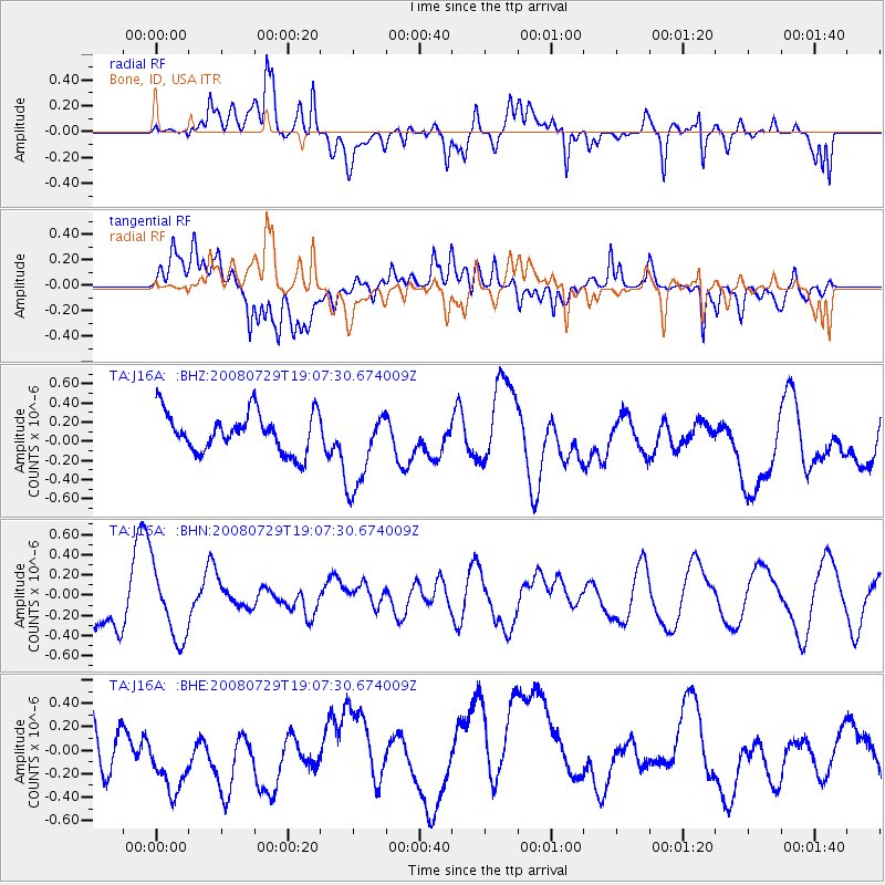
J16A Bone, ID, USA - Earthquake Result Viewer
*The percent match for this event was below the threshold and hence no stack was calculated.
| Earthquake location: |
New Ireland Region, P.N.G. |
| Earthquake latitude/longitude: |
-2.7/152.7 |
| Earthquake time(UTC): |
2008/07/29 (211) 18:54:35 GMT |
| Earthquake Depth: |
10 km |
| Earthquake Magnitude: |
5.5 MB, 5.1 MS, 5.2 MW |
| Earthquake Catalog/Contributor: |
WHDF/NEIC |
|
| Network: |
TA USArray Transportable Network (new EarthScope stations) |
| Station: |
J16A Bone, ID, USA |
| Lat/Lon: |
43.27 N/111.61 W |
| Elevation: |
2004 m |
|
| Distance: |
96.0 deg |
| Az: |
46.947 deg |
| Baz: |
271.977 deg |
| Ray Param: |
$rayparam |
*The percent match for this event was below the threshold and hence was not used in the summary stack. |
|
| Radial Match: |
69.3139 % |
| Radial Bump: |
400 |
| Transverse Match: |
57.811806 % |
| Transverse Bump: |
400 |
| SOD ConfigId: |
2504 |
| Insert Time: |
2010-03-06 16:37:49.401 +0000 |
| GWidth: |
2.5 |
| Max Bumps: |
400 |
| Tol: |
0.001 |
|
Signal To Noise
| Channel | StoN | STA | LTA |
| TA:J16A: :BHN:20080729T19:07:30.674009Z | 1.3313977 | 3.5343248E-7 | 2.6545973E-7 |
| TA:J16A: :BHE:20080729T19:07:30.674009Z | 0.9533435 | 3.213854E-7 | 3.3711396E-7 |
| TA:J16A: :BHZ:20080729T19:07:30.674009Z | 2.0909348 | 4.3112124E-7 | 2.0618587E-7 |
| Arrivals |
| Ps | |
| PpPs | |
| PsPs/PpSs | |


