You are here: Home > Network List > UW - Pacific Northwest Regional Seismic Network Stations List
> Station UMAT Pilot Rock, OR, USA > Earthquake Result Viewer
UMAT Pilot Rock, OR, USA - Earthquake Result Viewer

| Earthquake location: |
New Britain Region, P.N.G. |
| Earthquake latitude/longitude: |
-5.9/151.4 |
| Earthquake time(UTC): |
2018/10/10 (283) 20:48:20 GMT |
| Earthquake Depth: |
33 km |
| Earthquake Magnitude: |
7.3 Mi |
| Earthquake Catalog/Contributor: |
NEIC PDE/at |
|
| Network: |
UW Pacific Northwest Regional Seismic Network |
| Station: |
UMAT Pilot Rock, OR, USA |
| Lat/Lon: |
45.29 N/118.96 W |
| Elevation: |
1318 m |
|
| Distance: |
93.9 deg |
| Az: |
45.033 deg |
| Baz: |
265.602 deg |
| Ray Param: |
0.041156642 |
| Estimated Moho Depth: |
35.5 km |
| Estimated Crust Vp/Vs: |
1.83 |
| Assumed Crust Vp: |
6.571 km/s |
| Estimated Crust Vs: |
3.595 km/s |
| Estimated Crust Poisson's Ratio: |
0.29 |
|
| Radial Match: |
92.27496 % |
| Radial Bump: |
356 |
| Transverse Match: |
72.842415 % |
| Transverse Bump: |
400 |
| SOD ConfigId: |
13570011 |
| Insert Time: |
2019-05-01 11:18:02.091 +0000 |
| GWidth: |
2.5 |
| Max Bumps: |
400 |
| Tol: |
0.001 |
|
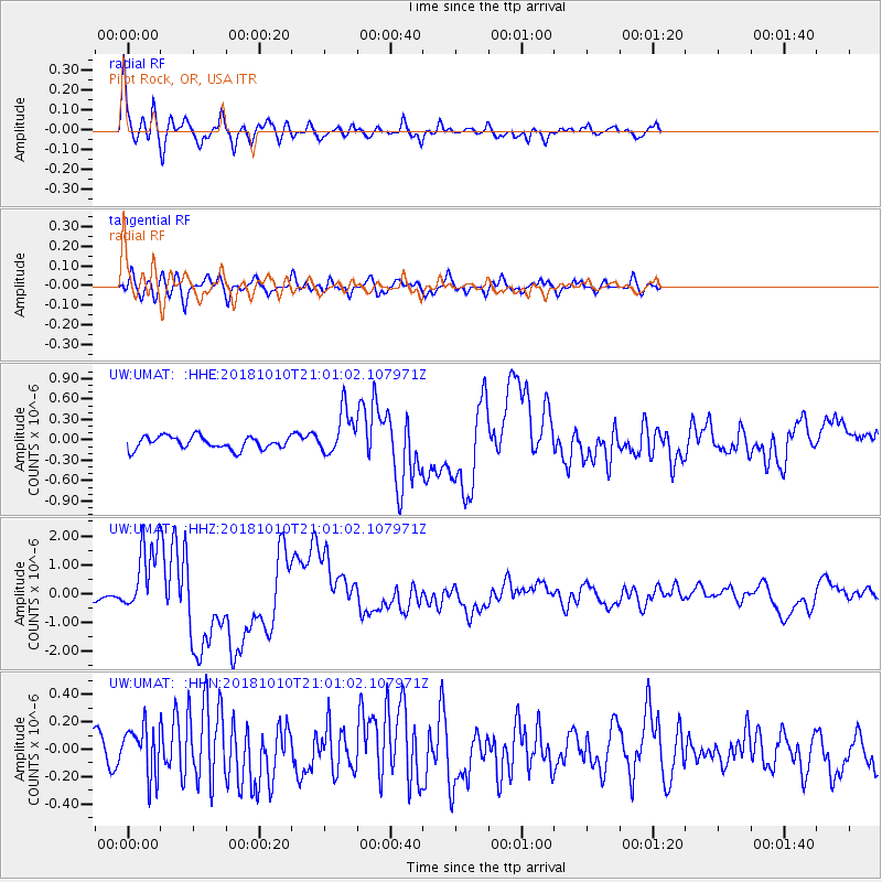
Signal To Noise
| Channel | StoN | STA | LTA |
| UW:UMAT: :HHZ:20181010T21:01:02.107971Z | 7.5412097 | 1.2551676E-6 | 1.6644115E-7 |
| UW:UMAT: :HHN:20181010T21:01:02.107971Z | 1.2505361 | 1.8067644E-7 | 1.4447919E-7 |
| UW:UMAT: :HHE:20181010T21:01:02.107971Z | 4.0984225 | 3.722362E-7 | 9.082425E-8 |
| Arrivals |
| Ps | 4.6 SECOND |
| PpPs | 15 SECOND |
| PsPs/PpSs | 20 SECOND |


