You are here: Home > Network List > TA - USArray Transportable Network (new EarthScope stations) Stations List
> Station D23K Nanushuk River, AK USA > Earthquake Result Viewer
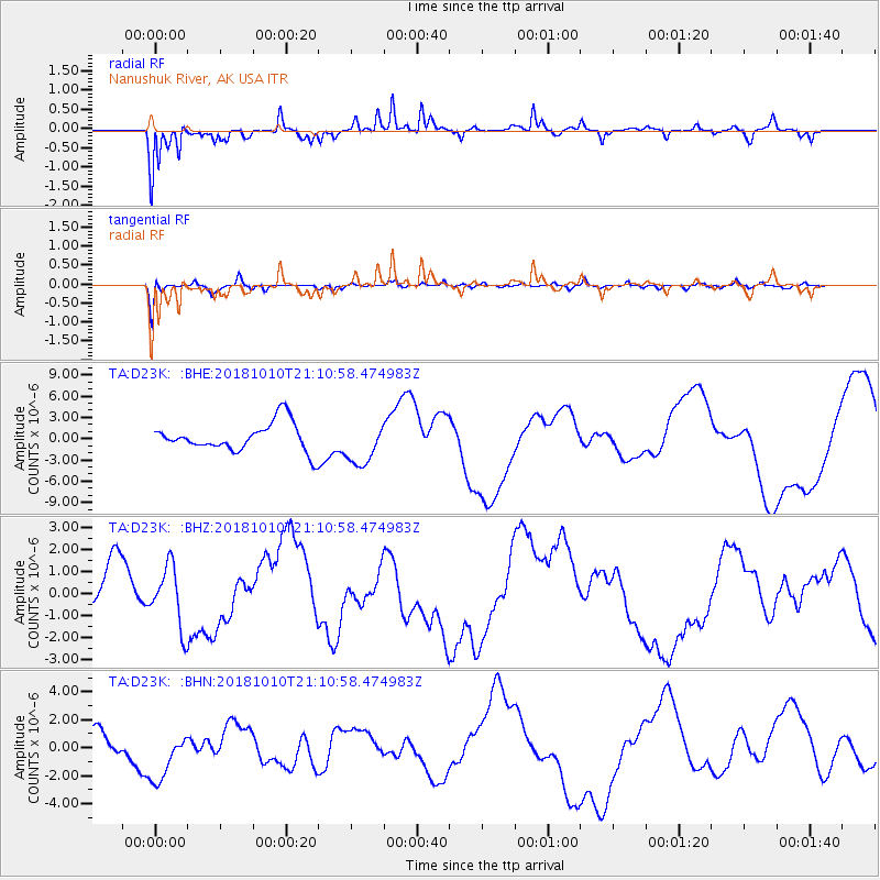
D23K Nanushuk River, AK USA - Earthquake Result Viewer
*The percent match for this event was below the threshold and hence no stack was calculated.
| Earthquake location: |
New Britain Region, P.N.G. |
| Earthquake latitude/longitude: |
-6.0/151.1 |
| Earthquake time(UTC): |
2018/10/10 (283) 20:59:01 GMT |
| Earthquake Depth: |
49 km |
| Earthquake Magnitude: |
5.7 mb |
| Earthquake Catalog/Contributor: |
NEIC PDE/us |
|
| Network: |
TA USArray Transportable Network (new EarthScope stations) |
| Station: |
D23K Nanushuk River, AK USA |
| Lat/Lon: |
68.97 N/150.68 W |
| Elevation: |
406 m |
|
| Distance: |
84.7 deg |
| Az: |
17.957 deg |
| Baz: |
238.143 deg |
| Ray Param: |
$rayparam |
*The percent match for this event was below the threshold and hence was not used in the summary stack. |
|
| Radial Match: |
85.041405 % |
| Radial Bump: |
315 |
| Transverse Match: |
73.113396 % |
| Transverse Bump: |
344 |
| SOD ConfigId: |
13570011 |
| Insert Time: |
2019-05-01 11:23:42.559 +0000 |
| GWidth: |
2.5 |
| Max Bumps: |
400 |
| Tol: |
0.001 |
|
Signal To Noise
| Channel | StoN | STA | LTA |
| TA:D23K: :BHZ:20181010T21:10:58.474983Z | 1.6582768 | 1.3656505E-6 | 8.235359E-7 |
| TA:D23K: :BHN:20181010T21:10:58.474983Z | 2.5682585 | 1.899072E-6 | 7.394396E-7 |
| TA:D23K: :BHE:20181010T21:10:58.474983Z | 1.4350877 | 2.9677362E-6 | 2.0679825E-6 |
| Arrivals |
| Ps | |
| PpPs | |
| PsPs/PpSs | |


