You are here: Home > Network List > TA - USArray Transportable Network (new EarthScope stations) Stations List
> Station F20K Avaraart Lake, AK, USA > Earthquake Result Viewer
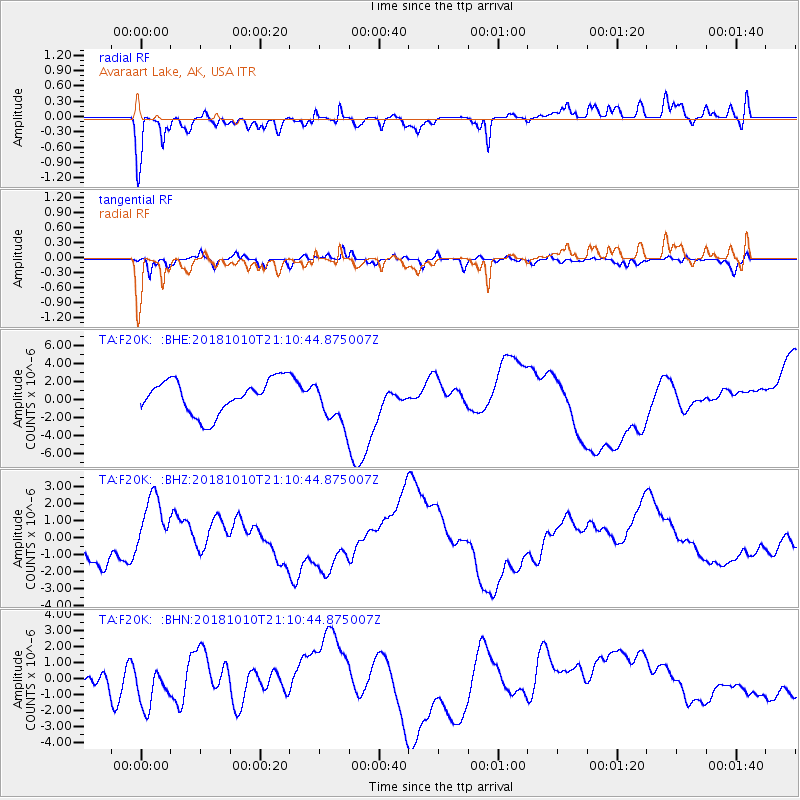
F20K Avaraart Lake, AK, USA - Earthquake Result Viewer
*The percent match for this event was below the threshold and hence no stack was calculated.
| Earthquake location: |
New Britain Region, P.N.G. |
| Earthquake latitude/longitude: |
-6.0/151.1 |
| Earthquake time(UTC): |
2018/10/10 (283) 20:59:01 GMT |
| Earthquake Depth: |
49 km |
| Earthquake Magnitude: |
5.7 mb |
| Earthquake Catalog/Contributor: |
NEIC PDE/us |
|
| Network: |
TA USArray Transportable Network (new EarthScope stations) |
| Station: |
F20K Avaraart Lake, AK, USA |
| Lat/Lon: |
67.05 N/155.73 W |
| Elevation: |
136 m |
|
| Distance: |
82.0 deg |
| Az: |
18.486 deg |
| Baz: |
233.53 deg |
| Ray Param: |
$rayparam |
*The percent match for this event was below the threshold and hence was not used in the summary stack. |
|
| Radial Match: |
58.572334 % |
| Radial Bump: |
400 |
| Transverse Match: |
52.682224 % |
| Transverse Bump: |
339 |
| SOD ConfigId: |
13570011 |
| Insert Time: |
2019-05-01 11:23:55.245 +0000 |
| GWidth: |
2.5 |
| Max Bumps: |
400 |
| Tol: |
0.001 |
|
Signal To Noise
| Channel | StoN | STA | LTA |
| TA:F20K: :BHZ:20181010T21:10:44.875007Z | 2.2710845 | 1.9692454E-6 | 8.670947E-7 |
| TA:F20K: :BHN:20181010T21:10:44.875007Z | 2.1672845 | 1.2863463E-6 | 5.935291E-7 |
| TA:F20K: :BHE:20181010T21:10:44.875007Z | 1.5803101 | 2.986586E-6 | 1.8898734E-6 |
| Arrivals |
| Ps | |
| PpPs | |
| PsPs/PpSs | |


