You are here: Home > Network List > TA - USArray Transportable Network (new EarthScope stations) Stations List
> Station H31M Peel River, Yukon, CAN > Earthquake Result Viewer
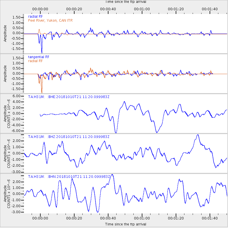
H31M Peel River, Yukon, CAN - Earthquake Result Viewer
*The percent match for this event was below the threshold and hence no stack was calculated.
| Earthquake location: |
New Britain Region, P.N.G. |
| Earthquake latitude/longitude: |
-6.0/151.1 |
| Earthquake time(UTC): |
2018/10/10 (283) 20:59:01 GMT |
| Earthquake Depth: |
49 km |
| Earthquake Magnitude: |
5.7 mb |
| Earthquake Catalog/Contributor: |
NEIC PDE/us |
|
| Network: |
TA USArray Transportable Network (new EarthScope stations) |
| Station: |
H31M Peel River, Yukon, CAN |
| Lat/Lon: |
65.81 N/134.34 W |
| Elevation: |
642 m |
|
| Distance: |
89.2 deg |
| Az: |
23.412 deg |
| Baz: |
253.524 deg |
| Ray Param: |
$rayparam |
*The percent match for this event was below the threshold and hence was not used in the summary stack. |
|
| Radial Match: |
86.20373 % |
| Radial Bump: |
254 |
| Transverse Match: |
62.64231 % |
| Transverse Bump: |
395 |
| SOD ConfigId: |
13570011 |
| Insert Time: |
2019-05-01 11:24:20.159 +0000 |
| GWidth: |
2.5 |
| Max Bumps: |
400 |
| Tol: |
0.001 |
|
Signal To Noise
| Channel | StoN | STA | LTA |
| TA:H31M: :BHZ:20181010T21:11:20.099983Z | 3.108807 | 9.4430686E-7 | 3.0375216E-7 |
| TA:H31M: :BHN:20181010T21:11:20.099983Z | 2.126773 | 5.9789676E-7 | 2.811286E-7 |
| TA:H31M: :BHE:20181010T21:11:20.099983Z | 2.0941195 | 9.666741E-7 | 4.616136E-7 |
| Arrivals |
| Ps | |
| PpPs | |
| PsPs/PpSs | |


