You are here: Home > Network List > TA - USArray Transportable Network (new EarthScope stations) Stations List
> Station J14A Carey, ID, USA > Earthquake Result Viewer
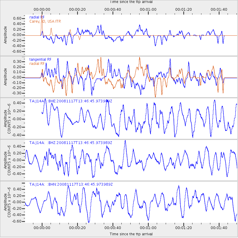
J14A Carey, ID, USA - Earthquake Result Viewer
*The percent match for this event was below the threshold and hence no stack was calculated.
| Earthquake location: |
Arctic Ocean |
| Earthquake latitude/longitude: |
79.7/-115.7 |
| Earthquake time(UTC): |
2008/11/17 (322) 13:40:11 GMT |
| Earthquake Depth: |
10 km |
| Earthquake Magnitude: |
5.7 ML, 5.1 MB |
| Earthquake Catalog/Contributor: |
WHDF/NEIC |
|
| Network: |
TA USArray Transportable Network (new EarthScope stations) |
| Station: |
J14A Carey, ID, USA |
| Lat/Lon: |
43.32 N/113.52 W |
| Elevation: |
1649 m |
|
| Distance: |
36.5 deg |
| Az: |
177.381 deg |
| Baz: |
359.353 deg |
| Ray Param: |
$rayparam |
*The percent match for this event was below the threshold and hence was not used in the summary stack. |
|
| Radial Match: |
45.289967 % |
| Radial Bump: |
400 |
| Transverse Match: |
53.836365 % |
| Transverse Bump: |
400 |
| SOD ConfigId: |
2658 |
| Insert Time: |
2010-03-06 16:40:43.767 +0000 |
| GWidth: |
2.5 |
| Max Bumps: |
400 |
| Tol: |
0.001 |
|
Signal To Noise
| Channel | StoN | STA | LTA |
| TA:J14A: :BHZ:20081117T13:46:45.973989Z | 0.832368 | 2.0328689E-7 | 2.4422718E-7 |
| TA:J14A: :BHN:20081117T13:46:45.973989Z | 1.0970486 | 2.2990665E-7 | 2.0956833E-7 |
| TA:J14A: :BHE:20081117T13:46:45.973989Z | 1.0238614 | 2.1264295E-7 | 2.0768722E-7 |
| Arrivals |
| Ps | |
| PpPs | |
| PsPs/PpSs | |


