You are here: Home > Network List > AZ - ANZA Regional Network Stations List
> Station SMER AZ.SMER > Earthquake Result Viewer
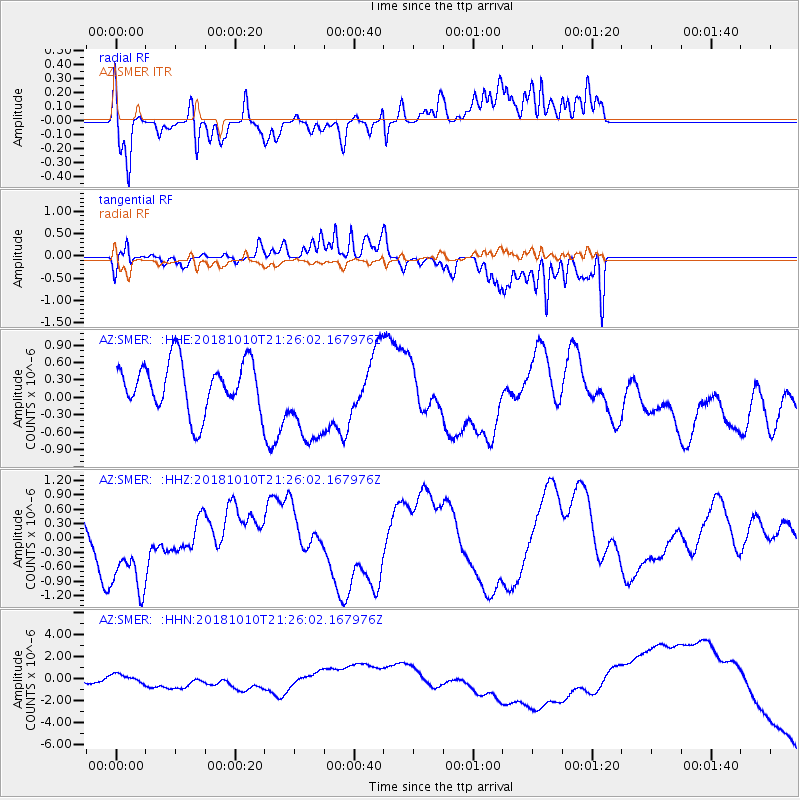
SMER AZ.SMER - Earthquake Result Viewer
*The percent match for this event was below the threshold and hence no stack was calculated.
| Earthquake location: |
New Britain Region, P.N.G. |
| Earthquake latitude/longitude: |
-5.9/151.1 |
| Earthquake time(UTC): |
2018/10/10 (283) 21:13:16 GMT |
| Earthquake Depth: |
37 km |
| Earthquake Magnitude: |
5.9 Mww |
| Earthquake Catalog/Contributor: |
NEIC PDE/us |
|
| Network: |
AZ ANZA Regional Network |
| Station: |
SMER AZ.SMER |
| Lat/Lon: |
33.46 N/117.17 W |
| Elevation: |
355 m |
|
| Distance: |
94.6 deg |
| Az: |
56.969 deg |
| Baz: |
265.986 deg |
| Ray Param: |
$rayparam |
*The percent match for this event was below the threshold and hence was not used in the summary stack. |
|
| Radial Match: |
56.776993 % |
| Radial Bump: |
356 |
| Transverse Match: |
54.2898 % |
| Transverse Bump: |
285 |
| SOD ConfigId: |
13570011 |
| Insert Time: |
2019-05-01 11:27:43.128 +0000 |
| GWidth: |
2.5 |
| Max Bumps: |
400 |
| Tol: |
0.001 |
|
Signal To Noise
| Channel | StoN | STA | LTA |
| AZ:SMER: :HHZ:20181010T21:26:02.167976Z | 1.3660003 | 9.1757465E-7 | 6.717236E-7 |
| AZ:SMER: :HHN:20181010T21:26:02.167976Z | 0.7252526 | 3.53775E-7 | 4.8779555E-7 |
| AZ:SMER: :HHE:20181010T21:26:02.167976Z | 1.8442767 | 8.021141E-7 | 4.349207E-7 |
| Arrivals |
| Ps | |
| PpPs | |
| PsPs/PpSs | |


