You are here: Home > Network List > CN - Canadian National Seismograph Network Stations List
> Station INK INUVIK, NT > Earthquake Result Viewer
INK INUVIK, NT - Earthquake Result Viewer
*The percent match for this event was below the threshold and hence no stack was calculated.
| Earthquake location: |
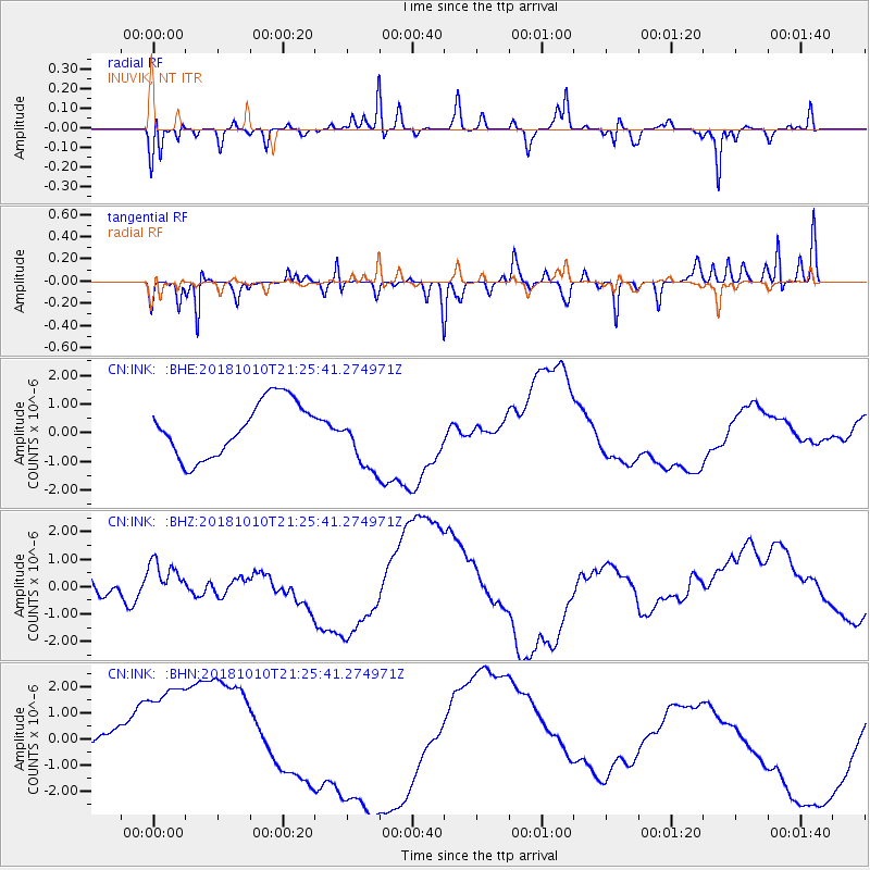
New Britain Region, P.N.G. |
| Earthquake latitude/longitude: |
-5.9/151.1 |
| Earthquake time(UTC): |
2018/10/10 (283) 21:13:16 GMT |
| Earthquake Depth: |
37 km |
| Earthquake Magnitude: |
5.9 Mww |
| Earthquake Catalog/Contributor: |
NEIC PDE/us |
|
| Network: |
CN Canadian National Seismograph Network |
| Station: |
INK INUVIK, NT |
| Lat/Lon: |
68.31 N/133.53 W |
| Elevation: |
44 m |
|
| Distance: |
90.1 deg |
| Az: |
21.081 deg |
| Baz: |
254.222 deg |
| Ray Param: |
$rayparam |
*The percent match for this event was below the threshold and hence was not used in the summary stack. |
|
| Radial Match: |
52.175987 % |
| Radial Bump: |
309 |
| Transverse Match: |
50.757668 % |
| Transverse Bump: |
243 |
| SOD ConfigId: |
13570011 |
| Insert Time: |
2019-05-01 11:28:33.007 +0000 |
| GWidth: |
2.5 |
| Max Bumps: |
400 |
| Tol: |
0.001 |
|
Signal To Noise
| Channel | StoN | STA | LTA |
| CN:INK: :BHZ:20181010T21:25:41.274971Z | 0.79434466 | 9.009665E-7 | 1.1342261E-6 |
| CN:INK: :BHN:20181010T21:25:41.274971Z | 4.3867145 | 2.6088096E-6 | 5.9470693E-7 |
| CN:INK: :BHE:20181010T21:25:41.274971Z | 1.210809 | 1.1544324E-6 | 9.534389E-7 |
| Arrivals |
| Ps | |
| PpPs | |
| PsPs/PpSs | |


