You are here: Home > Network List > TA - USArray Transportable Network (new EarthScope stations) Stations List
> Station L15K Ungalak Mountain, AK, USA > Earthquake Result Viewer
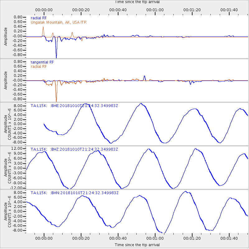
L15K Ungalak Mountain, AK, USA - Earthquake Result Viewer
*The percent match for this event was below the threshold and hence no stack was calculated.
| Earthquake location: |
New Britain Region, P.N.G. |
| Earthquake latitude/longitude: |
-5.9/151.1 |
| Earthquake time(UTC): |
2018/10/10 (283) 21:13:16 GMT |
| Earthquake Depth: |
37 km |
| Earthquake Magnitude: |
5.9 Mww |
| Earthquake Catalog/Contributor: |
NEIC PDE/us |
|
| Network: |
TA USArray Transportable Network (new EarthScope stations) |
| Station: |
L15K Ungalak Mountain, AK, USA |
| Lat/Lon: |
61.68 N/161.49 W |
| Elevation: |
219 m |
|
| Distance: |
76.6 deg |
| Az: |
21.141 deg |
| Baz: |
228.787 deg |
| Ray Param: |
$rayparam |
*The percent match for this event was below the threshold and hence was not used in the summary stack. |
|
| Radial Match: |
96.71349 % |
| Radial Bump: |
400 |
| Transverse Match: |
62.75313 % |
| Transverse Bump: |
400 |
| SOD ConfigId: |
13570011 |
| Insert Time: |
2019-05-01 11:30:38.444 +0000 |
| GWidth: |
2.5 |
| Max Bumps: |
400 |
| Tol: |
0.001 |
|
Signal To Noise
| Channel | StoN | STA | LTA |
| TA:L15K: :BHZ:20181010T21:24:32.349983Z | 2.0886993 | 9.698625E-6 | 4.6433797E-6 |
| TA:L15K: :BHN:20181010T21:24:32.349983Z | 1.257438 | 4.1733347E-6 | 3.3189192E-6 |
| TA:L15K: :BHE:20181010T21:24:32.349983Z | 1.1034111 | 5.4675065E-6 | 4.955095E-6 |
| Arrivals |
| Ps | |
| PpPs | |
| PsPs/PpSs | |


