You are here: Home > Network List > TA - USArray Transportable Network (new EarthScope stations) Stations List
> Station Q17K Contact Creek, Katmai, AK, USA > Earthquake Result Viewer
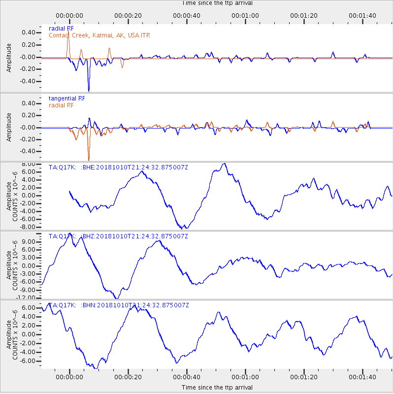
Q17K Contact Creek, Katmai, AK, USA - Earthquake Result Viewer
*The percent match for this event was below the threshold and hence no stack was calculated.
| Earthquake location: |
New Britain Region, P.N.G. |
| Earthquake latitude/longitude: |
-5.9/151.1 |
| Earthquake time(UTC): |
2018/10/10 (283) 21:13:16 GMT |
| Earthquake Depth: |
37 km |
| Earthquake Magnitude: |
5.9 Mww |
| Earthquake Catalog/Contributor: |
NEIC PDE/us |
|
| Network: |
TA USArray Transportable Network (new EarthScope stations) |
| Station: |
Q17K Contact Creek, Katmai, AK, USA |
| Lat/Lon: |
58.26 N/155.89 W |
| Elevation: |
1165 m |
|
| Distance: |
76.7 deg |
| Az: |
25.694 deg |
| Baz: |
234.679 deg |
| Ray Param: |
$rayparam |
*The percent match for this event was below the threshold and hence was not used in the summary stack. |
|
| Radial Match: |
98.4122 % |
| Radial Bump: |
263 |
| Transverse Match: |
62.1156 % |
| Transverse Bump: |
400 |
| SOD ConfigId: |
13570011 |
| Insert Time: |
2019-05-01 11:30:53.397 +0000 |
| GWidth: |
2.5 |
| Max Bumps: |
400 |
| Tol: |
0.001 |
|
Signal To Noise
| Channel | StoN | STA | LTA |
| TA:Q17K: :BHZ:20181010T21:24:32.875007Z | 1.8952224 | 1.1707571E-5 | 6.1774126E-6 |
| TA:Q17K: :BHN:20181010T21:24:32.875007Z | 0.57504505 | 2.4428757E-6 | 4.2481465E-6 |
| TA:Q17K: :BHE:20181010T21:24:32.875007Z | 0.74185437 | 2.3063978E-6 | 3.1089633E-6 |
| Arrivals |
| Ps | |
| PpPs | |
| PsPs/PpSs | |


