You are here: Home > Network List > AV - Alaska Volcano Observatory Stations List
> Station PLBL Mt. Peulik Volcano, Alaska > Earthquake Result Viewer
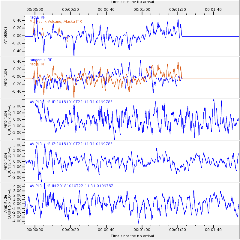
PLBL Mt. Peulik Volcano, Alaska - Earthquake Result Viewer
*The percent match for this event was below the threshold and hence no stack was calculated.
| Earthquake location: |
New Britain Region, P.N.G. |
| Earthquake latitude/longitude: |
-5.0/151.7 |
| Earthquake time(UTC): |
2018/10/10 (283) 22:00:34 GMT |
| Earthquake Depth: |
124 km |
| Earthquake Magnitude: |
6.3 Mww |
| Earthquake Catalog/Contributor: |
NEIC PDE/us |
|
| Network: |
AV Alaska Volcano Observatory |
| Station: |
PLBL Mt. Peulik Volcano, Alaska |
| Lat/Lon: |
57.70 N/156.82 W |
| Elevation: |
461 m |
|
| Distance: |
74.9 deg |
| Az: |
25.801 deg |
| Baz: |
233.863 deg |
| Ray Param: |
$rayparam |
*The percent match for this event was below the threshold and hence was not used in the summary stack. |
|
| Radial Match: |
62.760418 % |
| Radial Bump: |
400 |
| Transverse Match: |
65.20373 % |
| Transverse Bump: |
400 |
| SOD ConfigId: |
13570011 |
| Insert Time: |
2019-05-01 11:33:38.863 +0000 |
| GWidth: |
2.5 |
| Max Bumps: |
400 |
| Tol: |
0.001 |
|
Signal To Noise
| Channel | StoN | STA | LTA |
| AV:PLBL: :BHZ:20181010T22:11:31.019978Z | 3.473249 | 2.0552518E-6 | 5.9173755E-7 |
| AV:PLBL: :BHN:20181010T22:11:31.019978Z | 1.493617 | 1.6387108E-6 | 1.0971426E-6 |
| AV:PLBL: :BHE:20181010T22:11:31.019978Z | 0.54505527 | 6.240335E-7 | 1.1448994E-6 |
| Arrivals |
| Ps | |
| PpPs | |
| PsPs/PpSs | |


