You are here: Home > Network List > TA - USArray Transportable Network (new EarthScope stations) Stations List
> Station H16K Elim, AK, USA > Earthquake Result Viewer
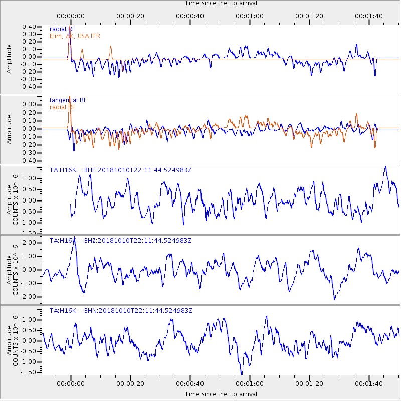
H16K Elim, AK, USA - Earthquake Result Viewer
*The percent match for this event was below the threshold and hence no stack was calculated.
| Earthquake location: |
New Britain Region, P.N.G. |
| Earthquake latitude/longitude: |
-5.0/151.7 |
| Earthquake time(UTC): |
2018/10/10 (283) 22:00:34 GMT |
| Earthquake Depth: |
124 km |
| Earthquake Magnitude: |
6.3 Mww |
| Earthquake Catalog/Contributor: |
NEIC PDE/us |
|
| Network: |
TA USArray Transportable Network (new EarthScope stations) |
| Station: |
H16K Elim, AK, USA |
| Lat/Lon: |
64.64 N/162.24 W |
| Elevation: |
216 m |
|
| Distance: |
77.3 deg |
| Az: |
18.544 deg |
| Baz: |
227.368 deg |
| Ray Param: |
$rayparam |
*The percent match for this event was below the threshold and hence was not used in the summary stack. |
|
| Radial Match: |
68.24875 % |
| Radial Bump: |
400 |
| Transverse Match: |
55.039356 % |
| Transverse Bump: |
400 |
| SOD ConfigId: |
13570011 |
| Insert Time: |
2019-05-01 11:38:19.588 +0000 |
| GWidth: |
2.5 |
| Max Bumps: |
400 |
| Tol: |
0.001 |
|
Signal To Noise
| Channel | StoN | STA | LTA |
| TA:H16K: :BHZ:20181010T22:11:44.524983Z | 2.2469876 | 1.3550709E-6 | 6.0306115E-7 |
| TA:H16K: :BHN:20181010T22:11:44.524983Z | 1.0256511 | 3.406245E-7 | 3.3210563E-7 |
| TA:H16K: :BHE:20181010T22:11:44.524983Z | 0.91567665 | 4.660576E-7 | 5.0897614E-7 |
| Arrivals |
| Ps | |
| PpPs | |
| PsPs/PpSs | |


