You are here: Home > Network List > TA - USArray Transportable Network (new EarthScope stations) Stations List
> Station I23K Minto, Yukon-Koyukuk, AK, USA > Earthquake Result Viewer
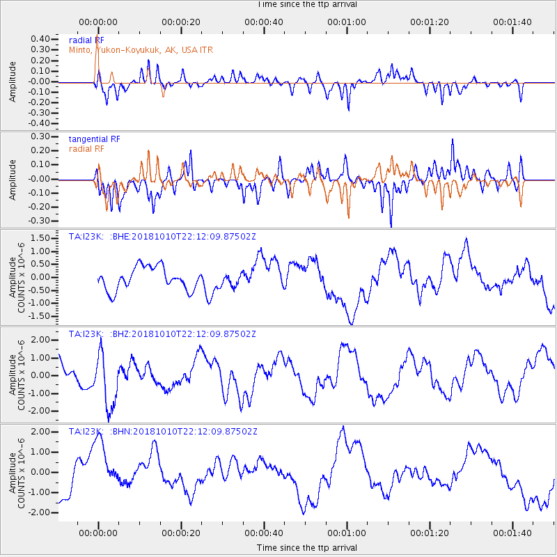
I23K Minto, Yukon-Koyukuk, AK, USA - Earthquake Result Viewer
*The percent match for this event was below the threshold and hence no stack was calculated.
| Earthquake location: |
New Britain Region, P.N.G. |
| Earthquake latitude/longitude: |
-5.0/151.7 |
| Earthquake time(UTC): |
2018/10/10 (283) 22:00:34 GMT |
| Earthquake Depth: |
124 km |
| Earthquake Magnitude: |
6.3 Mww |
| Earthquake Catalog/Contributor: |
NEIC PDE/us |
|
| Network: |
TA USArray Transportable Network (new EarthScope stations) |
| Station: |
I23K Minto, Yukon-Koyukuk, AK, USA |
| Lat/Lon: |
65.15 N/149.36 W |
| Elevation: |
149 m |
|
| Distance: |
82.0 deg |
| Az: |
21.448 deg |
| Baz: |
239.547 deg |
| Ray Param: |
$rayparam |
*The percent match for this event was below the threshold and hence was not used in the summary stack. |
|
| Radial Match: |
56.415985 % |
| Radial Bump: |
340 |
| Transverse Match: |
64.14492 % |
| Transverse Bump: |
400 |
| SOD ConfigId: |
13570011 |
| Insert Time: |
2019-05-01 11:38:29.243 +0000 |
| GWidth: |
2.5 |
| Max Bumps: |
400 |
| Tol: |
0.001 |
|
Signal To Noise
| Channel | StoN | STA | LTA |
| TA:I23K: :BHZ:20181010T22:12:09.87502Z | 1.8468577 | 1.5677051E-6 | 8.4884994E-7 |
| TA:I23K: :BHN:20181010T22:12:09.87502Z | 1.654772 | 1.3413106E-6 | 8.105712E-7 |
| TA:I23K: :BHE:20181010T22:12:09.87502Z | 0.5577288 | 2.4221774E-7 | 4.34293E-7 |
| Arrivals |
| Ps | |
| PpPs | |
| PsPs/PpSs | |


