I14A Mackay, ID, USA - Earthquake Result Viewer
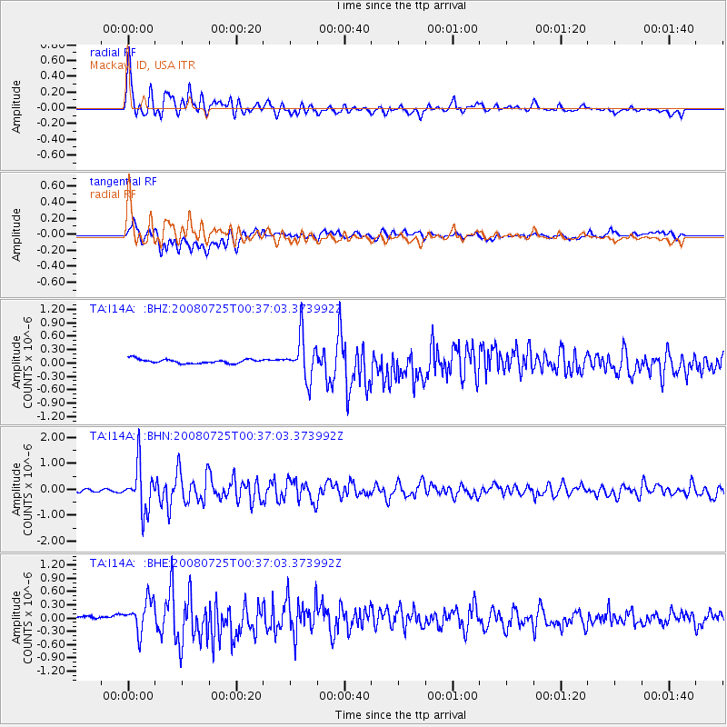
Earthquake location: Rat Islands, Aleutian Islands
Earthquake latitude/longitude: 51.3/179.0
Earthquake time(UTC): 2008/07/25 (207) 00:29:22 GMT
Earthquake Depth: 21 km
Earthquake Magnitude: 5.7 MB, 5.5 MS, 5.9 MW, 5.9 MW
Earthquake Catalog/Contributor: WHDF/NEIC
Network: TA USArray Transportable Network (new EarthScope stations)
Station: I14A Mackay, ID, USA
Lat/Lon: 43.93 N/113.45 W
Elevation: 1897 m
Distance: 44.7 deg
Az: 71.793 deg
Baz: 304.334 deg
Ray Param: 0.07174417
Estimated Moho Depth: 40.25 km
Estimated Crust Vp/Vs: 1.61
Assumed Crust Vp: 6.279 km/s
Estimated Crust Vs: 3.894 km/s
Estimated Crust Poisson's Ratio: 0.19
Radial Match: 85.160736 %
Radial Bump: 400
Transverse Match: 61.80284 %
Transverse Bump: 400
SOD ConfigId: 2504
Insert Time: 2010-03-06 16:41:58.622 +0000
GWidth: 2.5
Max Bumps: 400
Tol: 0.001

Signal To Noise

ChannelStoNSTALTA
TA:I14A: :BHN:20080725T00:37:03.373992Z10.356618.740897E-78.439921E-8
TA:I14A: :BHE:20080725T00:37:03.373992Z8.1289283.5898515E-74.416144E-8
TA:I14A: :BHZ:20080725T00:37:03.373992Z10.3178114.784221E-74.636857E-8
Arrivals
Ps4.2 SECOND
PpPs16 SECOND
PsPs/PpSs20 SECOND