
I14A Mackay, ID, USA - Earthquake Result Viewer
| ||||||||||||||||||
| ||||||||||||||||||
| ||||||||||||||||||
|
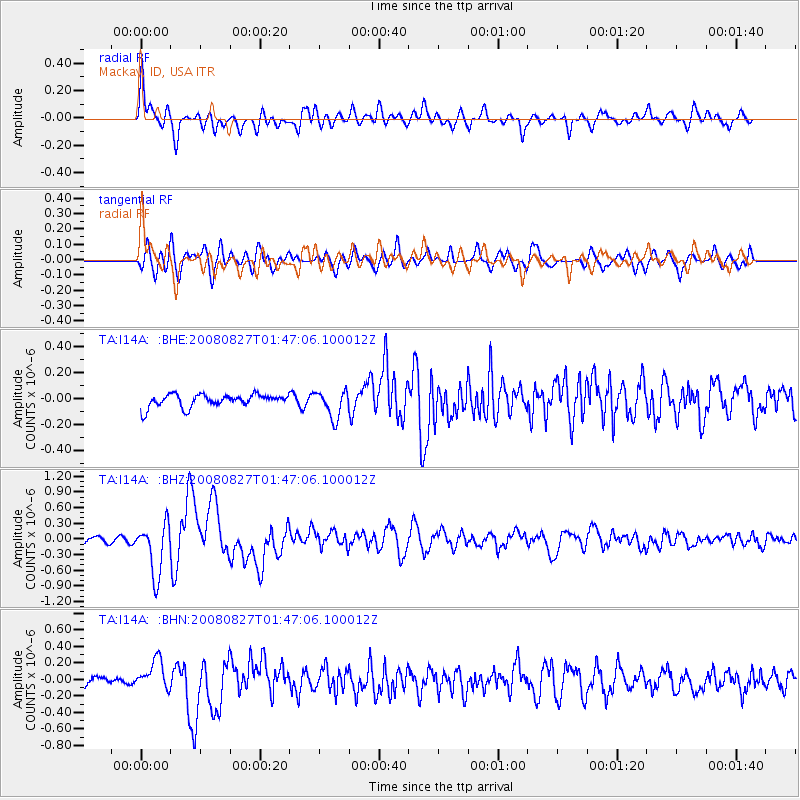
Signal To Noise
| Channel | StoN | STA | LTA |
| TA:I14A: :BHZ:20080827T01:47:06.100012Z | 6.576988 | 4.957171E-7 | 7.537144E-8 |
| TA:I14A: :BHN:20080827T01:47:06.100012Z | 2.26593 | 1.7931349E-7 | 7.913461E-8 |
| TA:I14A: :BHE:20080827T01:47:06.100012Z | 2.1416602 | 1.0453552E-7 | 4.8810506E-8 |
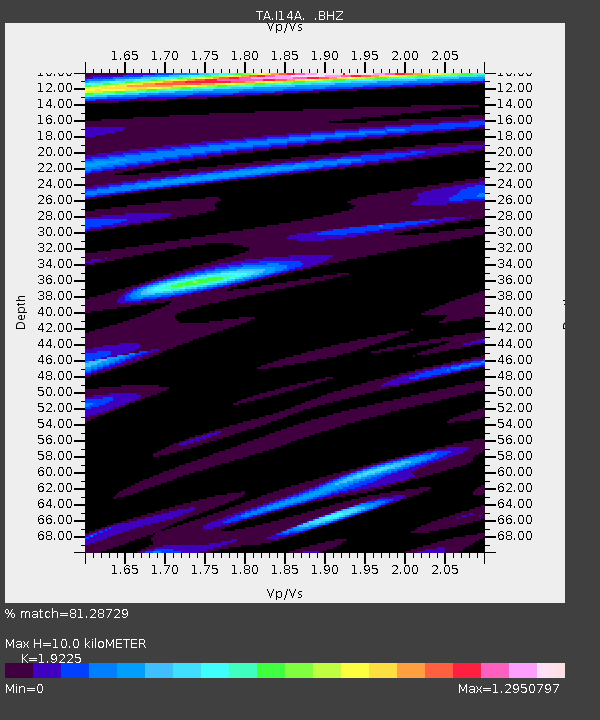
| Arrivals | |
| Ps | 1.5 SECOND |
| PpPs | 4.5 SECOND |
| PsPs/PpSs | 6.0 SECOND |

