You are here: Home > Network List > UW - Pacific Northwest Regional Seismic Network Stations List
> Station UMAT Pilot Rock, OR, USA > Earthquake Result Viewer
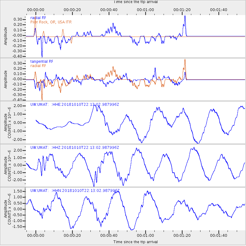
UMAT Pilot Rock, OR, USA - Earthquake Result Viewer
*The percent match for this event was below the threshold and hence no stack was calculated.
| Earthquake location: |
New Britain Region, P.N.G. |
| Earthquake latitude/longitude: |
-5.0/151.7 |
| Earthquake time(UTC): |
2018/10/10 (283) 22:00:34 GMT |
| Earthquake Depth: |
124 km |
| Earthquake Magnitude: |
6.3 Mww |
| Earthquake Catalog/Contributor: |
NEIC PDE/us |
|
| Network: |
UW Pacific Northwest Regional Seismic Network |
| Station: |
UMAT Pilot Rock, OR, USA |
| Lat/Lon: |
45.29 N/118.96 W |
| Elevation: |
1318 m |
|
| Distance: |
93.0 deg |
| Az: |
44.979 deg |
| Baz: |
266.068 deg |
| Ray Param: |
$rayparam |
*The percent match for this event was below the threshold and hence was not used in the summary stack. |
|
| Radial Match: |
84.53257 % |
| Radial Bump: |
345 |
| Transverse Match: |
74.005394 % |
| Transverse Bump: |
400 |
| SOD ConfigId: |
13570011 |
| Insert Time: |
2019-05-01 11:39:57.606 +0000 |
| GWidth: |
2.5 |
| Max Bumps: |
400 |
| Tol: |
0.001 |
|
Signal To Noise
| Channel | StoN | STA | LTA |
| UW:UMAT: :HHZ:20181010T22:13:02.987996Z | 2.1410334 | 6.9369116E-7 | 3.2399828E-7 |
| UW:UMAT: :HHN:20181010T22:13:02.987996Z | 0.5908007 | 2.3838484E-7 | 4.0349448E-7 |
| UW:UMAT: :HHE:20181010T22:13:02.987996Z | 7.0879602 | 1.8898028E-6 | 2.6662153E-7 |
| Arrivals |
| Ps | |
| PpPs | |
| PsPs/PpSs | |


