I14A Mackay, ID, USA - Earthquake Result Viewer
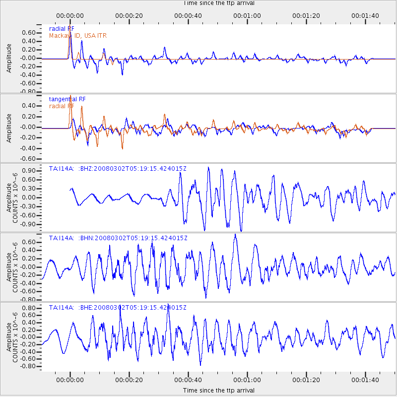
Earthquake location: Andreanof Islands, Aleutian Is.
Earthquake latitude/longitude: 51.9/-179.3
Earthquake time(UTC): 2008/03/02 (062) 05:11:44 GMT
Earthquake Depth: 21 km
Earthquake Magnitude: 5.6 MS, 5.4 MB, 5.8 MW, 5.7 MW
Earthquake Catalog/Contributor: WHDF/NEIC
Network: TA USArray Transportable Network (new EarthScope stations)
Station: I14A Mackay, ID, USA
Lat/Lon: 43.93 N/113.45 W
Elevation: 1897 m
Distance: 43.5 deg
Az: 73.369 deg
Baz: 304.672 deg
Ray Param: 0.07249251
Estimated Moho Depth: 34.25 km
Estimated Crust Vp/Vs: 1.70
Assumed Crust Vp: 6.279 km/s
Estimated Crust Vs: 3.704 km/s
Estimated Crust Poisson's Ratio: 0.23
Radial Match: 82.555305 %
Radial Bump: 400
Transverse Match: 57.09291 %
Transverse Bump: 400
SOD ConfigId: 2564
Insert Time: 2010-03-06 16:42:21.568 +0000
GWidth: 2.5
Max Bumps: 400
Tol: 0.001

Signal To Noise

ChannelStoNSTALTA
TA:I14A: :BHN:20080302T05:19:15.424015Z0.82100961.962861E-72.3907893E-7
TA:I14A: :BHE:20080302T05:19:15.424015Z2.15025332.026503E-79.424485E-8
TA:I14A: :BHZ:20080302T05:19:15.424015Z1.23695151.5555675E-71.2575816E-7
Arrivals
Ps4.0 SECOND
PpPs14 SECOND
PsPs/PpSs18 SECOND