I14A Mackay, ID, USA - Earthquake Result Viewer
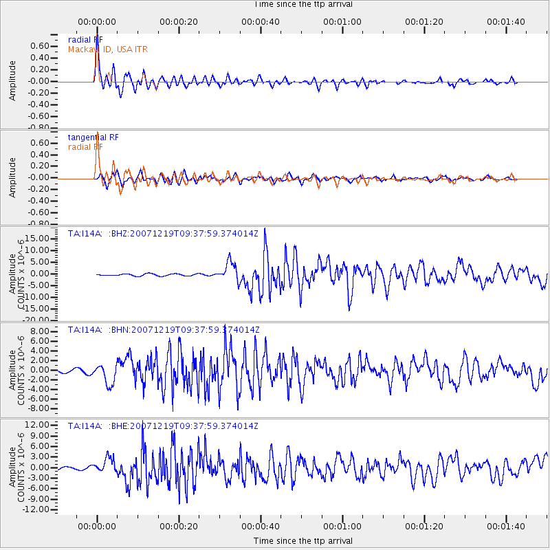
Earthquake location: Andreanof Islands, Aleutian Is.
Earthquake latitude/longitude: 51.4/-179.5
Earthquake time(UTC): 2007/12/19 (353) 09:30:27 GMT
Earthquake Depth: 29 km
Earthquake Magnitude: 6.4 MB, 7.1 MS, 7.1 MW, 7.0 MW
Earthquake Catalog/Contributor: WHDF/NEIC
Network: TA USArray Transportable Network (new EarthScope stations)
Station: I14A Mackay, ID, USA
Lat/Lon: 43.93 N/113.45 W
Elevation: 1897 m
Distance: 43.8 deg
Az: 72.747 deg
Baz: 304.039 deg
Ray Param: 0.07229116
Estimated Moho Depth: 33.25 km
Estimated Crust Vp/Vs: 1.74
Assumed Crust Vp: 6.279 km/s
Estimated Crust Vs: 3.619 km/s
Estimated Crust Poisson's Ratio: 0.25
Radial Match: 93.70547 %
Radial Bump: 400
Transverse Match: 83.95739 %
Transverse Bump: 400
SOD ConfigId: 2564
Insert Time: 2010-03-06 16:43:20.498 +0000
GWidth: 2.5
Max Bumps: 400
Tol: 0.001

Signal To Noise

ChannelStoNSTALTA
TA:I14A: :BHN:20071219T09:37:59.374014Z6.5372332.1311253E-63.259981E-7
TA:I14A: :BHE:20071219T09:37:59.374014Z5.78106362.1530934E-63.72439E-7
TA:I14A: :BHZ:20071219T09:37:59.374014Z9.5344014.1956096E-64.4004966E-7
Arrivals
Ps4.1 SECOND
PpPs14 SECOND
PsPs/PpSs18 SECOND