You are here: Home > Network List > IU - Global Seismograph Network (GSN - IRIS/USGS) Stations List
> Station GRFO Grafenberg, Germany > Earthquake Result Viewer
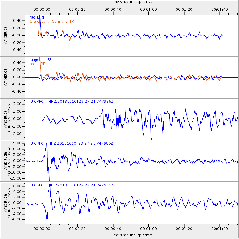
GRFO Grafenberg, Germany - Earthquake Result Viewer

| Earthquake location: |
Kuril Islands |
| Earthquake latitude/longitude: |
49.1/156.4 |
| Earthquake time(UTC): |
2018/10/10 (283) 23:16:04 GMT |
| Earthquake Depth: |
33 km |
| Earthquake Magnitude: |
6.8 Mi |
| Earthquake Catalog/Contributor: |
NEIC PDE/at |
|
| Network: |
IU Global Seismograph Network (GSN - IRIS/USGS) |
| Station: |
GRFO Grafenberg, Germany |
| Lat/Lon: |
49.69 N/11.22 E |
| Elevation: |
384 m |
|
| Distance: |
77.1 deg |
| Az: |
337.643 deg |
| Baz: |
22.641 deg |
| Ray Param: |
0.0504827 |
| Estimated Moho Depth: |
27.25 km |
| Estimated Crust Vp/Vs: |
2.03 |
| Assumed Crust Vp: |
6.182 km/s |
| Estimated Crust Vs: |
3.042 km/s |
| Estimated Crust Poisson's Ratio: |
0.34 |
|
| Radial Match: |
94.54103 % |
| Radial Bump: |
400 |
| Transverse Match: |
84.41343 % |
| Transverse Bump: |
400 |
| SOD ConfigId: |
13570011 |
| Insert Time: |
2019-05-01 11:45:53.808 +0000 |
| GWidth: |
2.5 |
| Max Bumps: |
400 |
| Tol: |
0.001 |
|
Signal To Noise
| Channel | StoN | STA | LTA |
| IU:GRFO: :HHZ:20181010T23:27:21.747986Z | 49.74362 | 8.169074E-6 | 1.6422355E-7 |
| IU:GRFO: :HH1:20181010T23:27:21.747986Z | 11.307075 | 3.5164658E-6 | 3.1099697E-7 |
| IU:GRFO: :HH2:20181010T23:27:21.747986Z | 2.0122333 | 6.511612E-7 | 3.2360123E-7 |
| Arrivals |
| Ps | 4.7 SECOND |
| PpPs | 13 SECOND |
| PsPs/PpSs | 18 SECOND |


