You are here: Home > Network List > UU - University of Utah Regional Network Stations List
> Station RDMU Red Mountain, UT, USA > Earthquake Result Viewer
RDMU Red Mountain, UT, USA - Earthquake Result Viewer

| Earthquake location: |
Mariana Islands |
| Earthquake latitude/longitude: |
18.5/145.5 |
| Earthquake time(UTC): |
2016/07/29 (211) 21:18:25 GMT |
| Earthquake Depth: |
212 km |
| Earthquake Magnitude: |
7.7 MWW, 7.7 MWB, 7.7 MI |
| Earthquake Catalog/Contributor: |
NEIC PDE/NEIC COMCAT |
|
| Network: |
UU University of Utah Regional Network |
| Station: |
RDMU Red Mountain, UT, USA |
| Lat/Lon: |
40.57 N/109.57 W |
| Elevation: |
2087 m |
|
| Distance: |
88.9 deg |
| Az: |
47.414 deg |
| Baz: |
293.49 deg |
| Ray Param: |
0.04173708 |
| Estimated Moho Depth: |
10.0 km |
| Estimated Crust Vp/Vs: |
1.60 |
| Assumed Crust Vp: |
6.207 km/s |
| Estimated Crust Vs: |
3.879 km/s |
| Estimated Crust Poisson's Ratio: |
0.18 |
|
| Radial Match: |
97.69718 % |
| Radial Bump: |
292 |
| Transverse Match: |
93.87289 % |
| Transverse Bump: |
400 |
| SOD ConfigId: |
1634031 |
| Insert Time: |
2016-08-12 21:31:41.606 +0000 |
| GWidth: |
2.5 |
| Max Bumps: |
400 |
| Tol: |
0.001 |
|
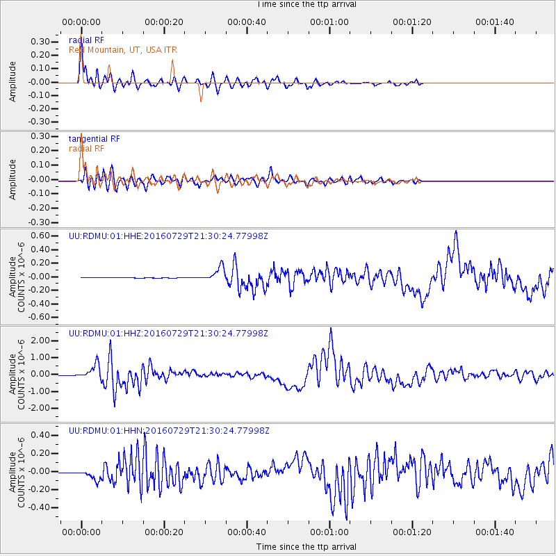
Signal To Noise
| Channel | StoN | STA | LTA |
| UU:RDMU:01:HHZ:20160729T21:30:24.77998Z | 148.3013 | 4.4787734E-7 | 3.0200498E-9 |
| UU:RDMU:01:HHN:20160729T21:30:24.77998Z | 24.964403 | 5.850914E-8 | 2.3437028E-9 |
| UU:RDMU:01:HHE:20160729T21:30:24.77998Z | 49.181698 | 1.0958181E-7 | 2.2281015E-9 |
| Arrivals |
| Ps | 1.0 SECOND |
| PpPs | 4.1 SECOND |
| PsPs/PpSs | 5.1 SECOND |


