You are here: Home > Network List > LD - Lamont-Doherty Cooperative Seismographic Network Stations List
> Station MVL Millersville University, PA > Earthquake Result Viewer
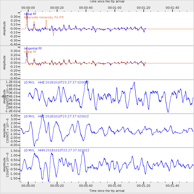
MVL Millersville University, PA - Earthquake Result Viewer
*The percent match for this event was below the threshold and hence no stack was calculated.
| Earthquake location: |
Kuril Islands |
| Earthquake latitude/longitude: |
49.1/156.4 |
| Earthquake time(UTC): |
2018/10/10 (283) 23:16:04 GMT |
| Earthquake Depth: |
33 km |
| Earthquake Magnitude: |
6.8 Mi |
| Earthquake Catalog/Contributor: |
NEIC PDE/at |
|
| Network: |
LD Lamont-Doherty Cooperative Seismographic Network |
| Station: |
MVL Millersville University, PA |
| Lat/Lon: |
40.00 N/76.35 W |
| Elevation: |
91 m |
|
| Distance: |
79.8 deg |
| Az: |
38.409 deg |
| Baz: |
327.889 deg |
| Ray Param: |
$rayparam |
*The percent match for this event was below the threshold and hence was not used in the summary stack. |
|
| Radial Match: |
83.12316 % |
| Radial Bump: |
359 |
| Transverse Match: |
83.228966 % |
| Transverse Bump: |
339 |
| SOD ConfigId: |
13570011 |
| Insert Time: |
2019-05-01 11:46:44.363 +0000 |
| GWidth: |
2.5 |
| Max Bumps: |
400 |
| Tol: |
0.001 |
|
Signal To Noise
| Channel | StoN | STA | LTA |
| LD:MVL: :HHZ:20181010T23:27:37.02002Z | 5.1465993 | 2.106429E-6 | 4.092856E-7 |
| LD:MVL: :HHN:20181010T23:27:37.02002Z | 2.94104 | 6.342657E-7 | 2.1566035E-7 |
| LD:MVL: :HHE:20181010T23:27:37.02002Z | 0.8501452 | 3.361857E-9 | 3.9544505E-9 |
| Arrivals |
| Ps | |
| PpPs | |
| PsPs/PpSs | |


