I14A Mackay, ID, USA - Earthquake Result Viewer
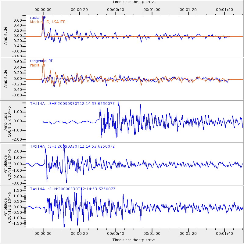
Earthquake location: Andreanof Islands, Aleutian Is.
Earthquake latitude/longitude: 51.5/-178.3
Earthquake time(UTC): 2009/03/30 (089) 12:07:28 GMT
Earthquake Depth: 31 km
Earthquake Magnitude: 6.0 MB, 5.5 MS, 5.7 MW, 5.7 MW
Earthquake Catalog/Contributor: WHDF/NEIC
Network: TA USArray Transportable Network (new EarthScope stations)
Station: I14A Mackay, ID, USA
Lat/Lon: 43.93 N/113.45 W
Elevation: 1897 m
Distance: 42.9 deg
Az: 73.665 deg
Baz: 303.946 deg
Ray Param: 0.072806835
Estimated Moho Depth: 16.5 km
Estimated Crust Vp/Vs: 1.84
Assumed Crust Vp: 6.279 km/s
Estimated Crust Vs: 3.408 km/s
Estimated Crust Poisson's Ratio: 0.29
Radial Match: 88.67262 %
Radial Bump: 400
Transverse Match: 80.78037 %
Transverse Bump: 400
SOD ConfigId: 2658
Insert Time: 2010-03-06 16:43:55.497 +0000
GWidth: 2.5
Max Bumps: 400
Tol: 0.001

Signal To Noise

ChannelStoNSTALTA
TA:I14A: :BHZ:20090330T12:14:53.625007Z9.0105981.0739511E-61.1918754E-7
TA:I14A: :BHN:20090330T12:14:53.625007Z3.5046823.929826E-71.1213075E-7
TA:I14A: :BHE:20090330T12:14:53.625007Z8.2402737.100598E-78.616945E-8
Arrivals
Ps2.4 SECOND
PpPs7.0 SECOND
PsPs/PpSs9.4 SECOND