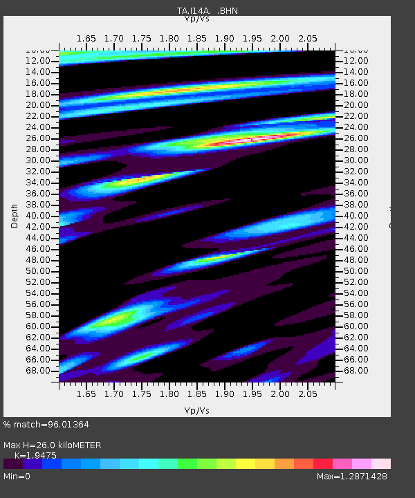
I14A Mackay, ID, USA - Earthquake Result Viewer
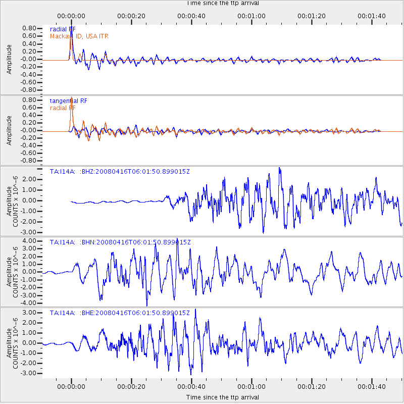
Earthquake location: Andreanof Islands, Aleutian Is.
Earthquake latitude/longitude: 51.9/-179.2
Earthquake time(UTC): 2008/04/16 (107) 05:54:19 GMT
Earthquake Depth: 13 km
Earthquake Magnitude: 6.1 MB, 6.5 MS, 6.6 MW, 6.6 MW
Earthquake Catalog/Contributor: WHDF/NEIC
Network: TA USArray Transportable Network (new EarthScope stations)
Station: I14A Mackay, ID, USA
Lat/Lon: 43.93 N/113.45 W
Elevation: 1897 m
Distance: 43.4 deg
Az: 73.477 deg
Baz: 304.661 deg
Ray Param: 0.07257572
Estimated Moho Depth: 26.0 km
Estimated Crust Vp/Vs: 1.95
Assumed Crust Vp: 6.279 km/s
Estimated Crust Vs: 3.224 km/s
Estimated Crust Poisson's Ratio: 0.32
Radial Match: 96.01364 %
Radial Bump: 400
Transverse Match: 87.955055 %
Transverse Bump: 400
SOD ConfigId: 2504
Insert Time: 2010-03-06 16:44:12.740 +0000
GWidth: 2.5
Max Bumps: 400
Tol: 0.001

Signal To Noise

ChannelStoNSTALTA
TA:I14A: :BHN:20080416T06:01:50.899015Z7.7135117.9361735E-71.0288665E-7
TA:I14A: :BHE:20080416T06:01:50.899015Z4.83873274.7069392E-79.727628E-8
TA:I14A: :BHZ:20080416T06:01:50.899015Z4.4906473.26842E-77.278284E-8
Arrivals
Ps4.2 SECOND
PpPs12 SECOND
PsPs/PpSs16 SECOND