
I14A Mackay, ID, USA - Earthquake Result Viewer
| ||||||||||||||||||
| ||||||||||||||||||
| ||||||||||||||||||
|
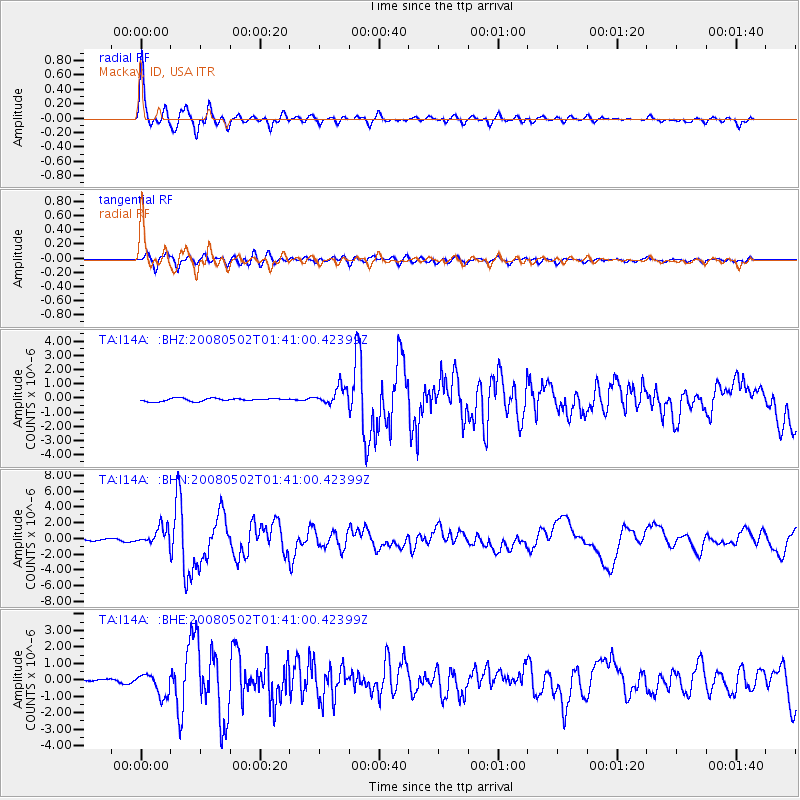
Signal To Noise
| Channel | StoN | STA | LTA |
| TA:I14A: :BHN:20080502T01:41:00.42399Z | 15.459879 | 1.1183744E-6 | 7.2340434E-8 |
| TA:I14A: :BHE:20080502T01:41:00.42399Z | 6.701558 | 6.8433536E-7 | 1.02115855E-7 |
| TA:I14A: :BHZ:20080502T01:41:00.42399Z | 6.1853323 | 6.235597E-7 | 1.0081264E-7 |
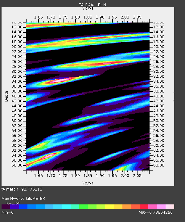
| Arrivals | |
| Ps | 7.5 SECOND |
| PpPs | 26 SECOND |
| PsPs/PpSs | 33 SECOND |

