You are here: Home > Network List > TA - USArray Transportable Network (new EarthScope stations) Stations List
> Station G23K Bananza Creek, AK, USA > Earthquake Result Viewer
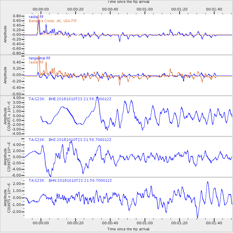
G23K Bananza Creek, AK, USA - Earthquake Result Viewer
*The percent match for this event was below the threshold and hence no stack was calculated.
| Earthquake location: |
Kuril Islands |
| Earthquake latitude/longitude: |
49.1/156.4 |
| Earthquake time(UTC): |
2018/10/10 (283) 23:16:04 GMT |
| Earthquake Depth: |
33 km |
| Earthquake Magnitude: |
6.8 Mi |
| Earthquake Catalog/Contributor: |
NEIC PDE/at |
|
| Network: |
TA USArray Transportable Network (new EarthScope stations) |
| Station: |
G23K Bananza Creek, AK, USA |
| Lat/Lon: |
66.71 N/150.02 W |
| Elevation: |
746 m |
|
| Distance: |
32.1 deg |
| Az: |
36.964 deg |
| Baz: |
263.699 deg |
| Ray Param: |
$rayparam |
*The percent match for this event was below the threshold and hence was not used in the summary stack. |
|
| Radial Match: |
77.635254 % |
| Radial Bump: |
400 |
| Transverse Match: |
76.28568 % |
| Transverse Bump: |
400 |
| SOD ConfigId: |
13570011 |
| Insert Time: |
2019-05-01 11:51:23.954 +0000 |
| GWidth: |
2.5 |
| Max Bumps: |
400 |
| Tol: |
0.001 |
|
Signal To Noise
| Channel | StoN | STA | LTA |
| TA:G23K: :BHZ:20181010T23:21:56.700012Z | 3.0371103 | 3.2324822E-6 | 1.0643282E-6 |
| TA:G23K: :BHN:20181010T23:21:56.700012Z | 0.6856954 | 3.3044E-7 | 4.81905E-7 |
| TA:G23K: :BHE:20181010T23:21:56.700012Z | 1.9274364 | 2.5993052E-6 | 1.3485817E-6 |
| Arrivals |
| Ps | |
| PpPs | |
| PsPs/PpSs | |


