You are here: Home > Network List > TA - USArray Transportable Network (new EarthScope stations) Stations List
> Station I14A Mackay, ID, USA > Earthquake Result Viewer
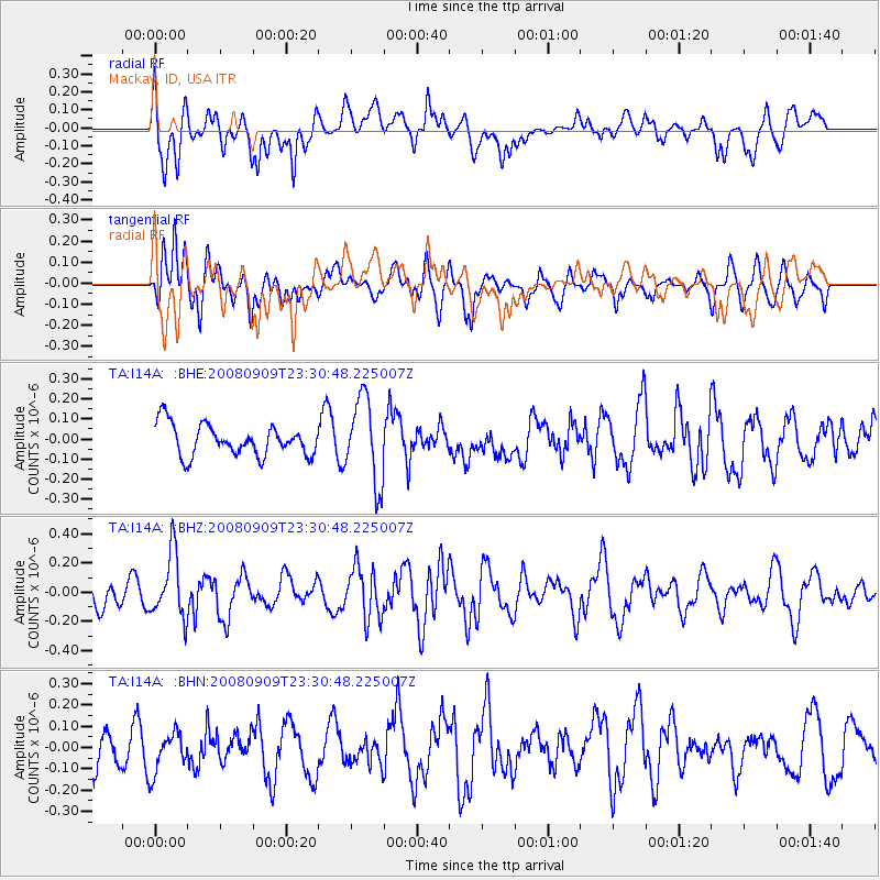
I14A Mackay, ID, USA - Earthquake Result Viewer
*The percent match for this event was below the threshold and hence no stack was calculated.
| Earthquake location: |
Santa Cruz Islands |
| Earthquake latitude/longitude: |
-11.8/166.5 |
| Earthquake time(UTC): |
2008/09/09 (253) 23:18:26 GMT |
| Earthquake Depth: |
99 km |
| Earthquake Magnitude: |
5.6 MW, 5.4 MB, 5.6 MW |
| Earthquake Catalog/Contributor: |
WHDF/NEIC |
|
| Network: |
TA USArray Transportable Network (new EarthScope stations) |
| Station: |
I14A Mackay, ID, USA |
| Lat/Lon: |
43.93 N/113.45 W |
| Elevation: |
1897 m |
|
| Distance: |
91.0 deg |
| Az: |
45.378 deg |
| Baz: |
254.696 deg |
| Ray Param: |
$rayparam |
*The percent match for this event was below the threshold and hence was not used in the summary stack. |
|
| Radial Match: |
60.57901 % |
| Radial Bump: |
400 |
| Transverse Match: |
68.52646 % |
| Transverse Bump: |
400 |
| SOD ConfigId: |
2560 |
| Insert Time: |
2010-03-06 16:45:10.717 +0000 |
| GWidth: |
2.5 |
| Max Bumps: |
400 |
| Tol: |
0.001 |
|
Signal To Noise
| Channel | StoN | STA | LTA |
| TA:I14A: :BHZ:20080909T23:30:48.225007Z | 1.9835935 | 2.1880413E-7 | 1.1030694E-7 |
| TA:I14A: :BHN:20080909T23:30:48.225007Z | 0.99795234 | 9.409414E-8 | 9.42872E-8 |
| TA:I14A: :BHE:20080909T23:30:48.225007Z | 2.7396994 | 2.1117297E-7 | 7.707889E-8 |
| Arrivals |
| Ps | |
| PpPs | |
| PsPs/PpSs | |


