You are here: Home > Network List > TA - USArray Transportable Network (new EarthScope stations) Stations List
> Station J25K Salcha River, AK, USA > Earthquake Result Viewer
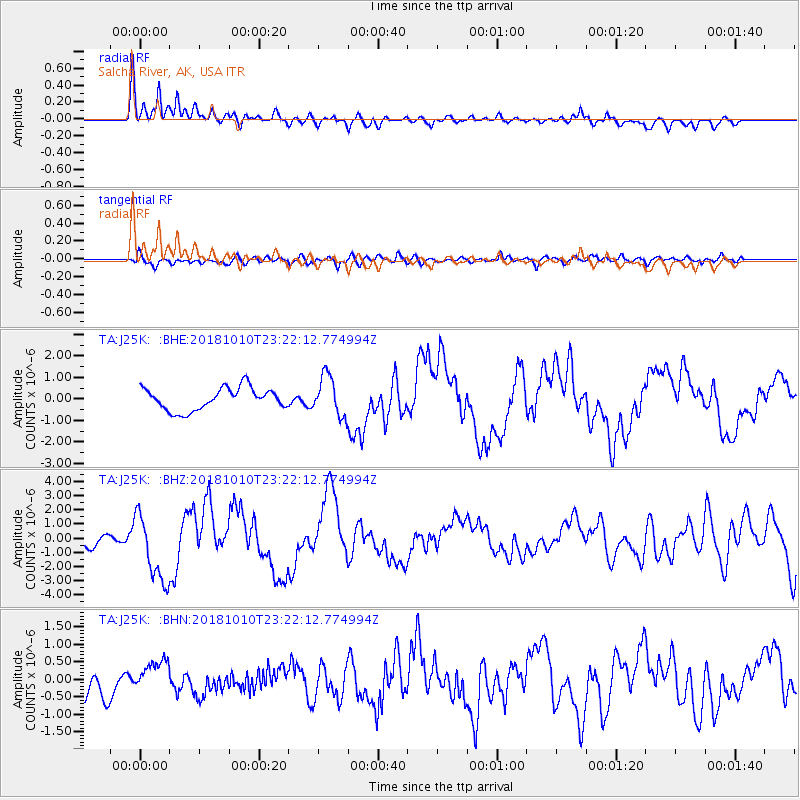
J25K Salcha River, AK, USA - Earthquake Result Viewer
*The percent match for this event was below the threshold and hence no stack was calculated.
| Earthquake location: |
Kuril Islands |
| Earthquake latitude/longitude: |
49.1/156.4 |
| Earthquake time(UTC): |
2018/10/10 (283) 23:16:04 GMT |
| Earthquake Depth: |
33 km |
| Earthquake Magnitude: |
6.8 Mi |
| Earthquake Catalog/Contributor: |
NEIC PDE/at |
|
| Network: |
TA USArray Transportable Network (new EarthScope stations) |
| Station: |
J25K Salcha River, AK, USA |
| Lat/Lon: |
64.61 N/145.37 W |
| Elevation: |
949 m |
|
| Distance: |
34.0 deg |
| Az: |
40.974 deg |
| Baz: |
271.297 deg |
| Ray Param: |
$rayparam |
*The percent match for this event was below the threshold and hence was not used in the summary stack. |
|
| Radial Match: |
86.83992 % |
| Radial Bump: |
400 |
| Transverse Match: |
67.5327 % |
| Transverse Bump: |
400 |
| SOD ConfigId: |
13570011 |
| Insert Time: |
2019-05-01 11:51:35.276 +0000 |
| GWidth: |
2.5 |
| Max Bumps: |
400 |
| Tol: |
0.001 |
|
Signal To Noise
| Channel | StoN | STA | LTA |
| TA:J25K: :BHZ:20181010T23:22:12.774994Z | 3.46007 | 2.4107633E-6 | 6.967383E-7 |
| TA:J25K: :BHN:20181010T23:22:12.774994Z | 1.198623 | 4.923456E-7 | 4.1075936E-7 |
| TA:J25K: :BHE:20181010T23:22:12.774994Z | 2.495366 | 1.2424086E-6 | 4.9788633E-7 |
| Arrivals |
| Ps | |
| PpPs | |
| PsPs/PpSs | |


